Area Overview for M15 5LY
Photos of M15 5LY

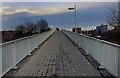
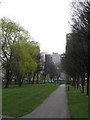
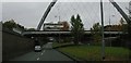
100 photos from this area
Area Information
Key information about the M15 5LY including its size, population, and administrative classification.
- Area Type
- Postcode
- Area Size
- 4841 m²
- Population
- 2389
- Population Density
- 9979 people/km²
House Prices in M15 5LY
12
Properties
£135,300
Average Sold Price
£37,700
Lowest Price
£240,000
Highest Price
Showing 12 properties
| Address | Type | Beds | Baths | Last Sale Price | Last Sale Date | |
|---|---|---|---|---|---|---|
| 18 Royce Road, Manchester, M15 5LY | Terraced | 2 | 1 | £240,000 | Sep 2025 | |
| 12 Royce Road, Manchester, M15 5LY | Terraced | 3 | 1 | £240,000 | Oct 2023 | |
| 2 Royce Road, Manchester, M15 5LY | house | 4 | 2 | £233,000 | May 2022 | |
| 10 Royce Road, Manchester, M15 5LY | Terraced | 2 | 1 | £135,000 | Jun 2016 | |
| 8 Royce Road, Manchester, M15 5LY | Terraced | 3 | 1 | £107,800 | Aug 2013 | |
| 14 Royce Road, Manchester, M15 5LY | Semi-detached | 3 | - | £113,000 | Jan 2013 | |
| 4 Royce Road, Manchester, M15 5LY | Semi-detached | 3 | - | £139,000 | Mar 2012 | |
| 20 Royce Road, Manchester, M15 5LY | Terraced | - | - | £145,000 | Aug 2007 | |
| 24 Royce Road, Manchester, M15 5LY | house | - | - | £134,700 | Jul 2004 | |
| 6 Royce Road, Manchester, M15 5LY | Terraced | - | - | £46,450 | Aug 1997 |
Page 1 of 2
Energy Efficiency in M15 5LY
Amenities
Schools
| Rank | School | Type | Entry gender | Ages |
|---|
Explore more schools in this area
Go to Schools tabDemographics
Household Size
Family (3-5 people)
most common
Accommodation Type
Houses
most common
Tenure
29
majority
Ethnic Group
White
most common
Religion
N/A
most common
Household Composition
N/A
most common
Age
22
median
Adults (30-64 years)
most common
Household Deprivation
N/A
with no deprivation
NS-SEC
31
in Lower managerial occupations
Explore more demographic insights in this area
Go to Demographics tabPlanning
Planning Constraints
- Flood RiskPremium
- Ramsar Wetland SitesPremium
- Area of Outstanding Natural BeautyPremium
- Protected Nature ReservePremium
- Protected WoodlandPremium