Area Overview for M15 5JL
Photos of M15 5JL


Area Information
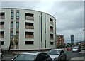
Living in M15 5JL means being part of a small, tightly knit residential cluster in England’s north-west, where 2,808 residents call home. This area is defined by its compact footprint and proximity to key urban hubs. The population skews young, with a median age of 22 and the majority of residents aged 15–29. Daily life here is shaped by its location, offering easy access to transport networks and a range of amenities. The area’s character is influenced by its housing stock, which is predominantly flats, reflecting a rental market dynamic. While the community is small, it is served by multiple schools, rail stations, and retail outlets, creating a functional environment for young professionals and families. The area’s appeal lies in its balance of convenience and affordability, though its limited size means residents often look beyond M15 5JL for broader opportunities. For those seeking a compact, connected living space with practical access to services, this postcode offers a distinct blend of urban proximity and residential simplicity.
- Area Type
- Postcode
- Area Size
- Not available
- Population
- 2808
- Population Density
- 6079 people/km²
The property market in M15 5JL is characterised by a high proportion of rented flats, with only 18% of homes owned by residents. This suggests a rental-dominated market, likely catering to young professionals and students who prioritise affordability and proximity to transport. The prevalence of flats indicates a lack of larger, owner-occupied properties, which may limit options for buyers seeking family homes or long-term investments. Given the area’s small size, the housing stock is limited, and buyers may need to look beyond M15 5JL for more diverse property choices. The rental market’s dominance also means competition for available units, particularly in desirable locations near schools and transport hubs. For those considering purchase, the area’s compact nature and limited home ownership rates suggest it is more suited to short-term stays or investment in rental properties rather than permanent family homes.
House Prices in M15 5JL
No properties found in this postcode.
Energy Efficiency in M15 5JL
The lifestyle in M15 5JL is shaped by its proximity to essential amenities and retail options. Nearby, residents can access Morrisons Daily, Co-op Hulme, and Farmfoods Hulme, providing a range of grocery and convenience shopping. The area’s rail, metro, and bus networks ensure easy access to urban centres, while City Airport Manchester offers travel convenience. Although parks and leisure facilities are not explicitly listed in the data, the presence of multiple transport hubs and retail outlets suggests a focus on practicality over expansive recreational spaces. The compact nature of the area means residents often venture beyond M15 5JL for larger amenities, but the immediate vicinity offers sufficient daily necessities. This balance of accessibility and limited local leisure options defines the area’s character, catering to those prioritising connectivity and convenience over expansive green spaces.
Amenities
Schools
Residents of M15 5JL have access to a range of educational institutions, including primary and sixth-form colleges. Royce Primary School and Rolls Crescent Primary School serve younger children, while Birley High School offers primary education, though its name may indicate a secondary focus. Loreto College provides sixth-form education, catering to students aged 16–18. The mix of primary and post-16 institutions creates a continuum of schooling options for families, though the absence of secondary schools within the postcode may require commuting for older students. The presence of multiple primary schools suggests a focus on early education, which is critical for young families. However, the lack of specific Ofsted ratings means the quality of these schools must be assessed independently. For parents prioritising a seamless educational journey, the proximity of these institutions is a practical advantage.
| Rank | School | Type | Entry gender | Ages |
|---|
Explore more schools in this area
Go to Schools tabDemographics
The community in M15 5JL is overwhelmingly young, with 22 as the median age and 15–29-year-olds comprising the largest demographic group. Home ownership is relatively low at 18%, indicating that the majority of residents rent their homes. The accommodation type is predominantly flats, which aligns with the area’s compact nature and rental market orientation. The predominant ethnic group is White, reflecting the broader demographic trends of the region. This age profile suggests a population focused on early career development or education, with limited presence of older households or retirees. The low home ownership rate may impact long-term investment potential for buyers, though it underscores the area’s role as a transient or rental-focused hub. The absence of specific deprivation data means quality of life factors like access to services and safety must be assessed through other metrics, such as the availability of schools and transport links.
Household Size
Accommodation Type
Tenure
Ethnic Group
Religion
Household Composition
Age
Household Deprivation
NS-SEC
Explore more demographic insights in this area
Go to Demographics tabPlanning
Planning Constraints
- Flood RiskPremium
- Ramsar Wetland SitesPremium
- Area of Outstanding Natural BeautyPremium
- Protected Nature ReservePremium
- Protected WoodlandPremium