Area Overview for M15 5HN
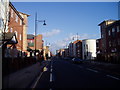
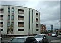
Photos of M15 5HN


Area Information
Living in M15 5HN means being part of a small, tightly knit residential cluster in England, home to 3,127 people. The area’s compact size fosters a sense of familiarity, with residents often knowing their neighbours. It is a young community, with a median age of 22 and the majority aged between 15 and 29. This demographic suggests a dynamic, student-influenced environment, given the proximity to The Manchester Metropolitan University. The area’s housing stock is dominated by flats, reflecting a rental market with only 14% of properties owner-occupied. Despite its small footprint, M15 5HN is well-connected, with nearby rail, metro, and bus services linking it to Manchester’s broader network. However, the area’s safety profile is a concern, with high crime rates reported. For those prioritising convenience, the mix of retail, transport, and educational institutions nearby offers a practical lifestyle, though buyers should weigh this against local challenges.
- Area Type
- Postcode
- Area Size
- Not available
- Population
- 3127
- Population Density
- 11248 people/km²
The property market in M15 5HN is characterised by a high proportion of rental properties, with only 14% of homes owner-occupied. This suggests a transient population, likely influenced by nearby educational institutions such as The Manchester Metropolitan University. The accommodation type is predominantly flats, which are common in urban areas with limited space. For buyers, this means the area is not a traditional owner-occupied market, and property options are constrained by the small postcode’s size. The focus on flats may appeal to those seeking affordable, manageable living spaces, but the low home ownership rate indicates limited long-term investment potential. Prospective buyers should also consider the area’s safety profile, which may affect property desirability. The immediate surroundings offer little variation in housing stock, making M15 5HN a niche choice for those prioritising location over ownership.
House Prices in M15 5HN
No properties found in this postcode.
Energy Efficiency in M15 5HN
Residents of M15 5HN enjoy a range of amenities within easy reach. Retail options include Co-op Hulme, Morrisons Daily, and Spar Stretford, offering everyday shopping needs. The area’s transport links—rail, metro, and bus—ensure convenient access to Manchester’s cultural and commercial hubs. While there is only one bus stop, the extensive rail and metro networks provide frequent service. The nearby City Airport Manchester adds to the area’s connectivity. For leisure, the proximity to Piccadilly Gardens and other urban spaces offers green spaces and public areas. The mix of retail, transport, and educational institutions creates a practical, urban lifestyle. However, the absence of major parks or leisure facilities within the postcode itself means residents may need to travel for more extensive recreation.
Amenities
Schools
Residents of M15 5HN have access to a range of educational institutions, from nursery to higher education. Martenscroft Nursery School & Children’s Centre provides early years education, while St Philip’s Church of England Primary School, rated ‘good’ by Ofsted, offers primary schooling. The Manchester Metropolitan University is also nearby, catering to higher education needs. This mix of school types ensures families can plan for their children’s education from early years through to university. The presence of a ‘good’ primary school may be a draw for families, though the absence of secondary schools within the area means students may need to commute. The proximity to a university also suggests a student population, which can influence the local community’s character and amenities.
| Rank | School | Type | Entry gender | Ages |
|---|
Explore more schools in this area
Go to Schools tabDemographics
The population of M15 5HN is overwhelmingly young, with a median age of 22 and the most common age range being 15–29 years. This suggests a community shaped by students, young professionals, and families with children. Only 14% of residents own their homes, indicating a strong rental market, with flats making up the majority of accommodation. The predominant ethnic group is White, though the data does not specify further diversity metrics. The low home ownership rate may reflect a transient population, with many residents renting short-term or commuting from elsewhere. For families, the area’s schools and proximity to higher education could be appealing, though the high crime risk may impact long-term stability. The demographic profile highlights a youthful, active community, but buyers should consider whether this aligns with their lifestyle preferences.
Household Size
Accommodation Type
Tenure
Ethnic Group
Religion
Household Composition
Age
Household Deprivation
NS-SEC
Explore more demographic insights in this area
Go to Demographics tabPlanning
Planning Constraints
- Flood RiskPremium
- Ramsar Wetland SitesPremium
- Area of Outstanding Natural BeautyPremium
- Protected Nature ReservePremium
- Protected WoodlandPremium