Area Overview for M15 4PR
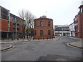
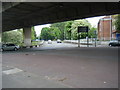
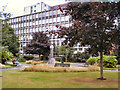
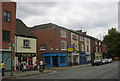
Photos of M15 4PR


Area Information
Living in M15 4PR means inhabiting a compact residential cluster in England with a population of 1,222. This small postcode area is defined by its proximity to urban infrastructure, with a mix of flats and a predominantly White community. The median age of 47 suggests a mature demographic, with most residents falling between 30 and 64 years old. Daily life here is shaped by accessibility to transport networks, including five rail stations and multiple metro stops, which connect residents to Manchester’s broader urban fabric. The area’s compact size means amenities are within practical reach, from retail outlets like Morrisons Daily to the nearby City Airport. While the housing stock is limited to flats, the area’s small footprint ensures a tight-knit community feel. For those prioritising convenience over space, M15 4PR offers a balance of urban connectivity and residential simplicity. However, the high crime risk reported in assessments is a notable consideration for potential residents.
- Area Type
- Postcode
- Area Size
- Not available
- Population
- 1222
- Population Density
- 7205 people/km²
The property market in M15 4PR is characterised by a high proportion of flats, with no data indicating the presence of detached or semi-detached homes. At 38% home ownership, the area leans heavily towards rental properties, suggesting a transient or leasehold-oriented market. This dynamic may appeal to buyers seeking short-term or flexible housing solutions but could limit long-term investment potential. The compact nature of the postcode means the housing stock is limited, and the immediate surroundings likely offer similar options. For buyers, this could mean a focus on flats in a specific price range, with limited scope for expansion or renovation. The area’s proximity to transport hubs may offset its smaller size, making it attractive to commuters or those prioritising convenience over property diversity.
House Prices in M15 4PR
No properties found in this postcode.
Energy Efficiency in M15 4PR
The lifestyle in M15 4PR is shaped by its proximity to a range of amenities. Retail options include major supermarkets such as Morrisons Daily and Sainsburys Manchester, ensuring everyday shopping needs are met. The area’s metro stops, like Piccadilly Gardens, provide access to public spaces and leisure opportunities, while the nearby City Airport caters to travel aspirations. Although the data does not specify dining or park facilities, the presence of multiple transport hubs suggests a dynamic urban environment. The compact nature of the postcode means residents can navigate the area on foot or by bike, fostering a sense of accessibility. However, the absence of detailed information on parks or cultural venues leaves some aspects of the lifestyle experience unexplored, requiring further local investigation.
Amenities
Schools
The nearest school to M15 4PR is Crown Street Primary School, a primary institution serving local children. No secondary schools are listed in the data, which may impact families requiring a full range of educational options. The presence of a primary school suggests the area is suitable for younger children, though parents of older students may need to look beyond the immediate vicinity for secondary education. The lack of additional schools in the data means the educational landscape here is limited to primary-level provision. This could be a consideration for families planning long-term stays, as they may need to factor in travel time or the availability of alternative schooling arrangements.
| Rank | School | Type | Entry gender | Ages |
|---|
Explore more schools in this area
Go to Schools tabDemographics
The community in M15 4PR is predominantly composed of adults aged 30–64, with a median age of 47. Home ownership here is relatively low, at 38%, indicating that a majority of residents are likely to rent their properties. The accommodation type is largely flats, reflecting a housing stock suited to urban living rather than detached homes. The predominant ethnic group is White, which aligns with broader trends in the region but offers limited insight into the area’s cultural diversity. The age profile suggests a stable, established population with fewer young families or elderly residents. This demographic structure may influence local services and amenities, with a focus on adult-oriented needs rather than schools or childcare facilities. The low home ownership rate also implies a rental market that could be competitive, with limited opportunities for property investment.
Household Size
Accommodation Type
Tenure
Ethnic Group
Religion
Household Composition
Age
Household Deprivation
NS-SEC
Explore more demographic insights in this area
Go to Demographics tabPlanning
Planning Constraints
- Flood RiskPremium
- Ramsar Wetland SitesPremium
- Area of Outstanding Natural BeautyPremium
- Protected Nature ReservePremium
- Protected WoodlandPremium