Area Overview for M15 4EL
Photos of M15 4EL


Area Information
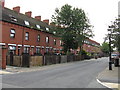
Living in M15 4EL means being part of a small, tightly knit residential cluster in England, home to 1,704 residents. The area is characterised by its compact size and proximity to essential services, making it practical for daily life. With a median age of 22, the community is young but skewed toward adults aged 30–64, suggesting a mix of established residents and newer arrivals. The area’s small footprint means amenities are within easy reach, from local shops to transport hubs. While it lacks the sprawling infrastructure of larger cities, M15 4EL offers a focused, accessible environment. Its location near major transport links and retail centres ensures connectivity without the congestion of more densely populated zones. For those prioritising convenience over space, this postcode provides a functional base with minimal commute times to nearby urban areas. The presence of schools, rail stations, and retail outlets within walking or short-vehicle distance reinforces its appeal as a practical, no-frills living option.
- Area Type
- Postcode
- Area Size
- Not available
- Population
- 1704
- Population Density
- 7342 people/km²
The property market in M15 4EL is dominated by flats, with only 21% of homes owner-occupied. This suggests a rental market where landlords predominate, and buyers seeking owner-occupied properties may find limited options. The small area’s housing stock is likely to be older, with fewer new builds given the low home ownership rate. For buyers, this means competition for a limited number of flats, which could drive up prices or reduce availability. The compact size of the postcode means the surrounding areas may offer more variety, but proximity to transport links and amenities remains a key selling point. Those considering purchase should weigh the potential for long-term value against the challenges of a rental-heavy market and the need to explore nearby zones for more housing choices.
House Prices in M15 4EL
No properties found in this postcode.
Energy Efficiency in M15 4EL
Daily life in M15 4EL is shaped by its proximity to a range of amenities. Residents can access five retail outlets, including Tesco Sky and Co-op Cornbrook, for groceries and essentials. The metro and rail stations provide easy access to nearby urban areas, while the Chorlton Street Coach Station offers additional public transport options. The nearby City Airport Manchester is a boon for frequent travellers. The area’s compact size means these services are within walking or short-vehicle distance, reducing the need for long commutes. The mix of retail, transport, and leisure options fosters a practical, convenience-driven lifestyle, ideal for those who value accessibility over sprawling suburban sprawl.
Amenities
Schools
Residents of M15 4EL have access to Chevassut County Primary School, a primary institution serving younger children, and Castlefield School, a special school catering to students with specific educational needs. The presence of both school types indicates a community that supports diverse educational requirements, from early years to specialist provision. For families, this means a range of options without the need to travel far, though the absence of secondary schools suggests reliance on nearby areas for further education. The mix of school types may appeal to parents seeking tailored support for their children, but the lack of data on Ofsted ratings means performance cannot be assessed.
| Rank | School | Type | Entry gender | Ages |
|---|
Explore more schools in this area
Go to Schools tabDemographics
M15 4EL’s population of 1,704 is predominantly adults aged 30–64, with a median age of 22, indicating a balance between younger and middle-aged residents. Only 21% of households are owner-occupied, with flats being the primary accommodation type. This suggests a rental-heavy market, likely attracting tenants rather than long-term homeowners. The predominant ethnic group is White, with no specific data on other demographics. The low home ownership rate may reflect economic pressures or a transient population. The age distribution implies a community with a mix of professionals and families, though the absence of data on deprivation means it’s unclear how this affects quality of life. The concentration of adults in the 30–64 range could indicate a stable workforce, but the lack of younger households may influence local services and amenities.
Household Size
Accommodation Type
Tenure
Ethnic Group
Religion
Household Composition
Age
Household Deprivation
NS-SEC
Explore more demographic insights in this area
Go to Demographics tabPlanning
Planning Constraints
- Flood RiskPremium
- Ramsar Wetland SitesPremium
- Area of Outstanding Natural BeautyPremium
- Protected Nature ReservePremium
- Protected WoodlandPremium