Area Overview for M15 4AW
Photos of M15 4AW


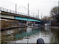
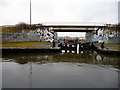


75 photos from this area
Area Information
Key information about the M15 4AW including its size, population, and administrative classification.
- Area Type
- Postcode
- Area Size
- 3164 m²
- Population
- 2397
- Population Density
- 9352 people/km²
House Prices in M15 4AW
22
Properties
£122,660
Average Sold Price
£40,000
Lowest Price
£225,000
Highest Price
Showing 22 properties
| Address | Type | Beds | Baths | Last Sale Price | Last Sale Date | |
|---|---|---|---|---|---|---|
| 377F Stretford Road, Manchester, M15 4AW | Flat | - | - | £160,000 | Nov 2023 | |
| 369A Stretford Road, Manchester, M15 4AW | Terraced | 4 | 2 | £176,000 | Sep 2022 | |
| 377B Stretford Road, Manchester, M15 4AW | Flat | - | - | £140,000 | Apr 2022 | |
| 369E Stretford Road, Manchester, M15 4AW | Flat | - | - | £141,500 | Nov 2021 | |
| 377A Stretford Road, Manchester, M15 4AW | Flat | - | - | £122,500 | May 2021 | |
| 377G Stretford Road, Manchester, M15 4AW | Flat | - | - | £145,000 | Feb 2021 | |
| 375D Stretford Road, Manchester, M15 4AW | Terraced | 4 | 1 | £225,000 | Jun 2019 | |
| 369B Stretford Road, Manchester, M15 4AW | Semi-detached | 4 | 2 | £125,000 | Jul 2018 | |
| 373B Stretford Road, Manchester, M15 4AW | Flat | 1 | 2 | £159,950 | Jun 2017 | |
| 369C Stretford Road, Manchester, M15 4AW | Flat | - | - | £107,000 | Dec 2016 |
Page 1 of 3
Energy Efficiency in M15 4AW
Amenities
Schools
| Rank | School | Type | Entry gender | Ages |
|---|
Explore more schools in this area
Go to Schools tabDemographics
Household Size
One person
most common
Accommodation Type
Flats
most common
Tenure
15
majority
Ethnic Group
White
most common
Religion
N/A
most common
Household Composition
N/A
most common
Age
47
median
Adults (30-64 years)
most common
Household Deprivation
N/A
with no deprivation
NS-SEC
22
in Lower managerial occupations
Explore more demographic insights in this area
Go to Demographics tabPlanning
Planning Constraints
- Flood RiskPremium
- Ramsar Wetland SitesPremium
- Area of Outstanding Natural BeautyPremium
- Protected Nature ReservePremium
- Protected WoodlandPremium