Area Overview for M14 7LL
Photos of M14 7LL
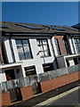
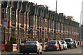
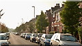
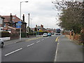
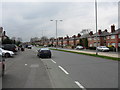
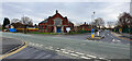
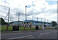

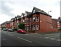
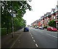
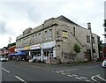
42 photos from this area
Area Information
Key information about the M14 7LL including its size, population, and administrative classification.
- Area Type
- Postcode
- Area Size
- 8046 m²
- Population
- 1619
- Population Density
- 7964 people/km²
House Prices in M14 7LL
29
Properties
£162,993
Average Sold Price
£79,000
Lowest Price
£275,000
Highest Price
Showing 29 properties
| Address | Type | Beds | Baths | Last Sale Price | Last Sale Date | |
|---|---|---|---|---|---|---|
| 42 Garswood Road, Manchester, M14 7LL | Semi-detached | 3 | 1 | £275,000 | May 2025 | |
| 46 Garswood Road, Manchester, M14 7LL | house | - | - | £225,000 | May 2024 | |
| 2 Garswood Road, Manchester, M14 7LL | house | - | - | £200,000 | Jun 2021 | |
| 54 Garswood Road, Manchester, M14 7LL | Semi-detached | 3 | - | £145,000 | Dec 2014 | |
| 44 Garswood Road, Manchester, M14 7LL | Semi-detached | - | - | £104,950 | Oct 2011 | |
| 30 Garswood Road, Manchester, M14 7LL | house | - | - | £112,000 | Aug 2009 | |
| 28 Garswood Road, Manchester, M14 7LL | Semi-detached | - | - | £79,000 | May 2003 | |
| 22 Garswood Road, Manchester, M14 7LL | house | - | - | - | - | |
| 26 Garswood Road, Manchester, M14 7LL | house | - | - | - | - | |
| 18 Garswood Road, Manchester, M14 7LL | house | - | - | - | - |
Page 1 of 3
Energy Efficiency in M14 7LL
Amenities
Schools
| Rank | School | Type | Entry gender | Ages |
|---|
Explore more schools in this area
Go to Schools tabDemographics
Household Size
Family (3-5 people)
most common
Accommodation Type
Houses
most common
Tenure
37
majority
Ethnic Group
White
most common
Religion
N/A
most common
Household Composition
N/A
most common
Age
22
median
Adults (30-64 years)
most common
Household Deprivation
N/A
with no deprivation
NS-SEC
18
in Lower managerial occupations
Explore more demographic insights in this area
Go to Demographics tabPlanning
Planning Constraints
- Flood RiskPremium
- Ramsar Wetland SitesPremium
- Area of Outstanding Natural BeautyPremium
- Protected Nature ReservePremium
- Protected WoodlandPremium