Area Overview for M14 7JA
Photos of M14 7JA

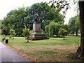
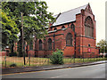
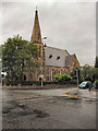
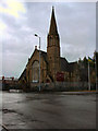
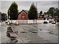
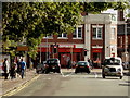
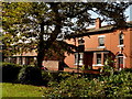
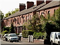
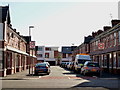
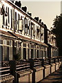
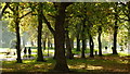
100 photos from this area
Area Information
Key information about the M14 7JA including its size, population, and administrative classification.
- Area Type
- Postcode
- Area Size
- 3114 m²
- Population
- 1868
- Population Density
- 19081 people/km²
House Prices in M14 7JA
30
Properties
£89,500
Average Sold Price
£20,000
Lowest Price
£160,000
Highest Price
Showing 30 properties
| Address | Type | Beds | Baths | Last Sale Price | Last Sale Date | |
|---|---|---|---|---|---|---|
| 20 Cranswick Street, Manchester, M14 7JA | Terraced | 2 | 1 | £160,000 | Aug 2025 | |
| 16 Cranswick Street, Manchester, M14 7JA | Semi-detached | 2 | 1 | £136,000 | Jun 2022 | |
| 64 Cranswick Street, Manchester, M14 7JA | house | - | - | £39,999 | Mar 2021 | |
| 42 Cranswick Street, Manchester, M14 7JA | Terraced | 2 | 1 | £125,000 | May 2018 | |
| 60 Cranswick Street, Manchester, M14 7JA | house | 2 | 1 | £116,000 | Jan 2018 | |
| 50 Cranswick Street, Manchester, M14 7JA | Terraced | 3 | 1 | £120,000 | Jul 2017 | |
| 52 Cranswick Street, Manchester, M14 7JA | Terraced | 4 | 1 | £121,000 | Jun 2017 | |
| 18 Cranswick Street, Manchester, M14 7JA | house | - | - | £108,000 | Mar 2016 | |
| 10 Cranswick Street, Manchester, M14 7JA | Terraced | 2 | 1 | £77,500 | Jul 2015 | |
| 56 Cranswick Street, Manchester, M14 7JA | Terraced | 2 | - | £92,000 | Sep 2014 |
Page 1 of 3
Energy Efficiency in M14 7JA
Amenities
Schools
| Rank | School | Type | Entry gender | Ages |
|---|
Explore more schools in this area
Go to Schools tabDemographics
Household Size
Family (3-5 people)
most common
Accommodation Type
Houses
most common
Tenure
22
majority
Ethnic Group
black_total
most common
Religion
N/A
most common
Household Composition
N/A
most common
Age
22
median
Adults (30-64 years)
most common
Household Deprivation
N/A
with no deprivation
NS-SEC
19
in Lower managerial occupations
Explore more demographic insights in this area
Go to Demographics tabPlanning
Planning Constraints
- Flood RiskPremium
- Ramsar Wetland SitesPremium
- Area of Outstanding Natural BeautyPremium
- Protected Nature ReservePremium
- Protected WoodlandPremium