Area Overview for M14 7DN
Photos of M14 7DN
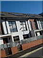
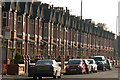

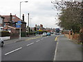
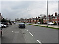
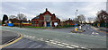


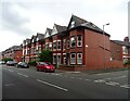
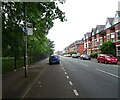
42 photos from this area
Area Information
Key information about the M14 7DN including its size, population, and administrative classification.
- Area Type
- Postcode
- Area Size
- 1.7 hectares
- Population
- 2295
- Population Density
- 5463 people/km²
House Prices in M14 7DN
27
Properties
£293,741
Average Sold Price
£23,500
Lowest Price
£625,000
Highest Price
Showing 27 properties
| Address | Type | Beds | Baths | Last Sale Price | Last Sale Date | |
|---|---|---|---|---|---|---|
| 77 Wilbraham Road, Manchester, M14 7DN | Detached | 4 | 1 | £375,000 | Aug 2024 | |
| 81 Wilbraham Road, Manchester, M14 7DN | Detached | 4 | 2 | £373,334 | Feb 2023 | |
| 93 Wilbraham Road, Manchester, M14 7DN | house | - | - | £625,000 | Nov 2022 | |
| 55 Wilbraham Road, Manchester, M14 7DN | house | - | - | £435,000 | Jun 2021 | |
| 79 Wilbraham Road, Manchester, M14 7DN | Terraced | 1 | 2 | £420,000 | Oct 2019 | |
| 97 Wilbraham Road, Manchester, M14 7DN | Detached | 4 | 2 | £435,000 | Nov 2018 | |
| 59 Wilbraham Road, Manchester, M14 7DN | Detached | 4 | 1 | £380,000 | Sep 2017 | |
| 101 Wilbraham Road, Manchester, M14 7DN | Semi-detached | 7 | 2 | £350,000 | Mar 2016 | |
| 75 Wilbraham Road, Manchester, M14 7DN | house | - | - | £249,000 | Mar 2014 | |
| 57 Wilbraham Road, Manchester, M14 7DN | house | - | - | £375,000 | Sep 2009 |
Page 1 of 3
Energy Efficiency in M14 7DN
Amenities
Schools
| Rank | School | Type | Entry gender | Ages |
|---|
Explore more schools in this area
Go to Schools tabDemographics
Household Size
Family (3-5 people)
most common
Accommodation Type
Houses
most common
Tenure
27
majority
Ethnic Group
White
most common
Religion
N/A
most common
Household Composition
N/A
most common
Age
22
median
Young Adults (15-29 years)
most common
Household Deprivation
N/A
with no deprivation
NS-SEC
20
in Lower managerial occupations
Explore more demographic insights in this area
Go to Demographics tabPlanning
Planning Constraints
- Flood RiskPremium
- Ramsar Wetland SitesPremium
- Area of Outstanding Natural BeautyPremium
- Protected Nature ReservePremium
- Protected WoodlandPremium