Area Overview for M14 7AE
Photos of M14 7AE
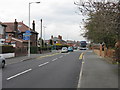
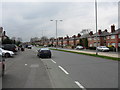
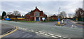
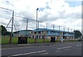

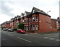
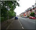
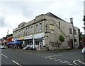
42 photos from this area
Area Information
Key information about the M14 7AE including its size, population, and administrative classification.
- Area Type
- Postcode
- Area Size
- 5932 m²
- Population
- 1920
- Population Density
- 3715 people/km²
House Prices in M14 7AE
17
Properties
£137,500
Average Sold Price
£39,000
Lowest Price
£202,000
Highest Price
Showing 17 properties
| Address | Type | Beds | Baths | Last Sale Price | Last Sale Date | |
|---|---|---|---|---|---|---|
| 73 Hart Road, Manchester, M14 7AE | Semi-detached | 3 | 1 | £190,000 | Dec 2020 | |
| 71 Hart Road, Manchester, M14 7AE | Semi-detached | 2 | 1 | £188,000 | Jan 2020 | |
| 87 Hart Road, Manchester, M14 7AE | house | - | - | £195,000 | Apr 2018 | |
| 83 Hart Road, Manchester, M14 7AE | house | 3 | - | £202,000 | Jul 2017 | |
| 75 Hart Road, Manchester, M14 7AE | house | 3 | 1 | £135,000 | Aug 2015 | |
| 81 Hart Road, Manchester, M14 7AE | Semi-detached | 3 | 1 | £125,000 | Dec 2014 | |
| 77 Hart Road, Manchester, M14 7AE | Semi-detached | 3 | - | £135,000 | Nov 2014 | |
| 67 Hart Road, Manchester, M14 7AE | Semi-detached | 3 | 1 | £105,000 | Mar 2013 | |
| 79 Hart Road, Manchester, M14 7AE | house | - | - | £61,000 | Jun 2002 | |
| 69 Hart Road, Manchester, M14 7AE | house | - | - | £39,000 | Dec 1999 |
Page 1 of 2
Energy Efficiency in M14 7AE
Amenities
Schools
| Rank | School | Type | Entry gender | Ages |
|---|
Explore more schools in this area
Go to Schools tabDemographics
Household Size
Family (3-5 people)
most common
Accommodation Type
Houses
most common
Tenure
34
majority
Ethnic Group
White
most common
Religion
N/A
most common
Household Composition
N/A
most common
Age
47
median
Adults (30-64 years)
most common
Household Deprivation
N/A
with no deprivation
NS-SEC
20
in Lower managerial occupations
Explore more demographic insights in this area
Go to Demographics tabPlanning
Planning Constraints
- Flood RiskPremium
- Ramsar Wetland SitesPremium
- Area of Outstanding Natural BeautyPremium
- Protected Nature ReservePremium
- Protected WoodlandPremium