Area Overview for M14 6SA
Photos of M14 6SA
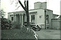
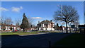
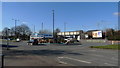
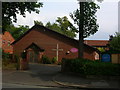
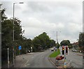
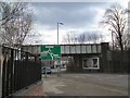
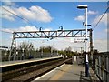
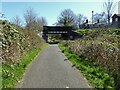

31 photos from this area
Area Information
Key information about the M14 6SA including its size, population, and administrative classification.
- Area Type
- Postcode
- Area Size
- 3454 m²
- Population
- 1825
- Population Density
- 8695 people/km²
House Prices in M14 6SA
13
Properties
£165,409
Average Sold Price
£36,000
Lowest Price
£300,000
Highest Price
Showing 13 properties
| Address | Type | Beds | Baths | Last Sale Price | Last Sale Date | |
|---|---|---|---|---|---|---|
| 50 Kingswood Road, Manchester, M14 6SA | Semi-detached | 3 | 1 | £300,000 | Jul 2024 | |
| 48 Kingswood Road, Manchester, M14 6SA | house | - | - | £275,000 | Jul 2024 | |
| 38 Kingswood Road, Manchester, M14 6SA | house | 5 | 2 | £240,000 | Feb 2017 | |
| 54 Kingswood Road, Manchester, M14 6SA | house | - | - | £170,000 | Nov 2015 | |
| 34 Kingswood Road, Manchester, M14 6SA | house | - | - | £235,000 | Oct 2015 | |
| 52 Kingswood Road, Manchester, M14 6SA | house | - | - | £159,000 | Aug 2015 | |
| 30 Kingswood Road, Manchester, M14 6SA | house | - | - | £92,500 | Jun 2012 | |
| 40 Kingswood Road, Manchester, M14 6SA | house | 5 | 2 | £114,000 | Sep 2003 | |
| 42 Kingswood Road, Manchester, M14 6SA | house | 2 | 1 | £104,000 | Jan 2003 | |
| 36 Kingswood Road, Manchester, M14 6SA | Terraced | 4 | 2 | £94,000 | Dec 2002 |
Page 1 of 2
Energy Efficiency in M14 6SA
Amenities
Schools
| Rank | School | Type | Entry gender | Ages |
|---|
Explore more schools in this area
Go to Schools tabDemographics
Household Size
Family (3-5 people)
most common
Accommodation Type
Houses
most common
Tenure
46
majority
Ethnic Group
White
most common
Religion
N/A
most common
Household Composition
N/A
most common
Age
22
median
Young Adults (15-29 years)
most common
Household Deprivation
N/A
with no deprivation
NS-SEC
26
in Lower managerial occupations
Explore more demographic insights in this area
Go to Demographics tabPlanning
Planning Constraints
- Flood RiskPremium
- Ramsar Wetland SitesPremium
- Area of Outstanding Natural BeautyPremium
- Protected Nature ReservePremium
- Protected WoodlandPremium