Area Overview for M14 5NJ
Photos of M14 5NJ
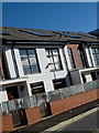
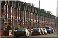
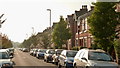
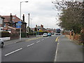
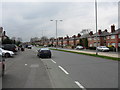
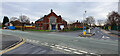
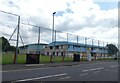

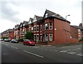
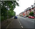
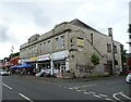
42 photos from this area
Area Information
Key information about the M14 5NJ including its size, population, and administrative classification.
- Area Type
- Postcode
- Area Size
- 2485 m²
- Population
- 1823
- Population Density
- 9796 people/km²
House Prices in M14 5NJ
20
Properties
£120,859
Average Sold Price
£150
Lowest Price
£255,000
Highest Price
Showing 20 properties
| Address | Type | Beds | Baths | Last Sale Price | Last Sale Date | |
|---|---|---|---|---|---|---|
| 263 Heald Place, Manchester, M14 5NJ | house | - | - | £255,000 | Jan 2025 | |
| 265 Heald Place, Manchester, M14 5NJ | Terraced | 5 | 1 | £221,000 | Jun 2024 | |
| 259 Heald Place, Manchester, M14 5NJ | house | - | - | £145,000 | Aug 2022 | |
| 249 Heald Place, Manchester, M14 5NJ | Terraced | 4 | 2 | £215,000 | Jul 2022 | |
| 251 Heald Place, Manchester, M14 5NJ | house | - | - | £210,000 | Apr 2022 | |
| 245 Heald Place, Manchester, M14 5NJ | Terraced | 2 | 1 | £157,500 | Jun 2018 | |
| 243 Heald Place, Manchester, M14 5NJ | Terraced | 2 | 1 | £140,000 | Jun 2017 | |
| 255 Heald Place, Manchester, M14 5NJ | Terraced | 3 | 1 | £140,000 | May 2008 | |
| 257 Heald Place, Manchester, M14 5NJ | house | 2 | 1 | £127,500 | Apr 2008 | |
| 253 Heald Place, Manchester, M14 5NJ | Terraced | 3 | 1 | £138,000 | Dec 2007 |
Page 1 of 2
Energy Efficiency in M14 5NJ
Amenities
Schools
| Rank | School | Type | Entry gender | Ages |
|---|
Explore more schools in this area
Go to Schools tabDemographics
Household Size
Family (3-5 people)
most common
Accommodation Type
Houses
most common
Tenure
20
majority
Ethnic Group
White
most common
Religion
N/A
most common
Household Composition
N/A
most common
Age
22
median
Young Adults (15-29 years)
most common
Household Deprivation
N/A
with no deprivation
NS-SEC
14
in Lower managerial occupations
Explore more demographic insights in this area
Go to Demographics tabPlanning
Planning Constraints
- Flood RiskPremium
- Ramsar Wetland SitesPremium
- Area of Outstanding Natural BeautyPremium
- Protected Nature ReservePremium
- Protected WoodlandPremium