Area Overview for M14 5GW
Photos of M14 5GW
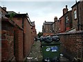
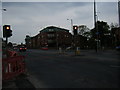
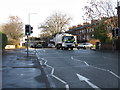
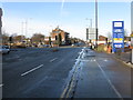
80 photos from this area
Area Information
Key information about the M14 5GW including its size, population, and administrative classification.
- Area Type
- Postcode
- Area Size
- 3803 m²
- Population
- 2094
- Population Density
- 10418 people/km²
House Prices in M14 5GW
12
Properties
£151,290
Average Sold Price
£55,500
Lowest Price
£270,000
Highest Price
Showing 12 properties
| Address | Type | Beds | Baths | Last Sale Price | Last Sale Date | |
|---|---|---|---|---|---|---|
| 51 Longford Place, Manchester, M14 5GW | Retail | 3 | 1 | £270,000 | Jul 2022 | |
| 55 Longford Place, Manchester, M14 5GW | Semi-detached | 3 | 1 | £231,000 | Jun 2019 | |
| 49 Longford Place, Manchester, M14 5GW | house | - | - | £140,000 | Dec 2013 | |
| 45 Longford Place, Manchester, M14 5GW | Semi-detached | - | - | £55,500 | Sep 2000 | |
| 47 Longford Place, Manchester, M14 5GW | Semi-detached | - | - | £59,950 | Aug 2000 | |
| 53 Longford Place, Manchester, M14 5GW | Semi-detached | - | - | - | - | |
| 59 Longford Place, Manchester, M14 5GW | house | - | - | - | - | |
| 57 Longford Place, Manchester, M14 5GW | Semi-detached | - | - | - | - | |
| Flat 4, 61 Longford Place, Manchester, M14 5GW | Flat | - | - | - | - | |
| Flat 3, 61 Longford Place, Manchester, M14 5GW | Flat | 3 | 1 | - | - |
Page 1 of 2
Energy Efficiency in M14 5GW
Amenities
Schools
| Rank | School | Type | Entry gender | Ages |
|---|
Explore more schools in this area
Go to Schools tabDemographics
Household Size
One person
most common
Accommodation Type
Flats
most common
Tenure
21
majority
Ethnic Group
asian_total
most common
Religion
N/A
most common
Household Composition
N/A
most common
Age
22
median
Young Adults (15-29 years)
most common
Household Deprivation
N/A
with no deprivation
NS-SEC
19
in Lower managerial occupations
Explore more demographic insights in this area
Go to Demographics tabPlanning
Planning Constraints
- Flood RiskPremium
- Ramsar Wetland SitesPremium
- Area of Outstanding Natural BeautyPremium
- Protected Nature ReservePremium
- Protected WoodlandPremium