Area Overview for M13 0QU
Photos of M13 0QU

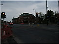


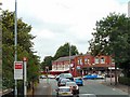
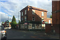
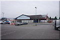

80 photos from this area
Area Information
Key information about the M13 0QU including its size, population, and administrative classification.
- Area Type
- Postcode
- Area Size
- 8674 m²
- Population
- 2037
- Population Density
- 12605 people/km²
House Prices in M13 0QU
44
Properties
£122,713
Average Sold Price
£19,500
Lowest Price
£270,000
Highest Price
Showing 44 properties
| Address | Type | Beds | Baths | Last Sale Price | Last Sale Date | |
|---|---|---|---|---|---|---|
| 97 Clitheroe Road, Manchester, M13 0QU | Semi-detached | 3 | 2 | £265,000 | Sep 2024 | |
| 57 Clitheroe Road, Manchester, M13 0QU | house | - | - | £227,500 | Jun 2024 | |
| 78 Clitheroe Road, Manchester, M13 0QU | house | - | - | £201,600 | Oct 2023 | |
| 61 Clitheroe Road, Manchester, M13 0QU | house | - | - | £238,000 | Jul 2022 | |
| 60 Clitheroe Road, Manchester, M13 0QU | house | 3 | 2 | £270,000 | Apr 2022 | |
| 69 Clitheroe Road, Manchester, M13 0QU | house | - | - | £217,000 | Jul 2021 | |
| 65 Clitheroe Road, Manchester, M13 0QU | house | - | - | £250,000 | Jun 2021 | |
| 80 Clitheroe Road, Manchester, M13 0QU | house | - | - | £155,000 | Feb 2019 | |
| 95 Clitheroe Road, Manchester, M13 0QU | house | - | - | £19,500 | Mar 2018 | |
| 64 Clitheroe Road, Manchester, M13 0QU | Semi-detached | 3 | 1 | £172,000 | Oct 2017 |
Page 1 of 5
Energy Efficiency in M13 0QU
Amenities
Schools
| Rank | School | Type | Entry gender | Ages |
|---|
Explore more schools in this area
Go to Schools tabDemographics
Household Size
Family (3-5 people)
most common
Accommodation Type
Houses
most common
Tenure
52
majority
Ethnic Group
asian_total
most common
Religion
N/A
most common
Household Composition
N/A
most common
Age
47
median
Adults (30-64 years)
most common
Household Deprivation
N/A
with no deprivation
NS-SEC
13
in Lower managerial occupations
Explore more demographic insights in this area
Go to Demographics tabPlanning
Planning Constraints
- Flood RiskPremium
- Ramsar Wetland SitesPremium
- Area of Outstanding Natural BeautyPremium
- Protected Nature ReservePremium
- Protected WoodlandPremium