Area Overview for M13 0GL
Photos of M13 0GL

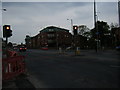


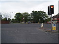
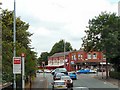
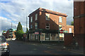


80 photos from this area
Area Information
Key information about the M13 0GL including its size, population, and administrative classification.
- Area Type
- Postcode
- Area Size
- 5974 m²
- Population
- 2313
- Population Density
- 11525 people/km²
House Prices in M13 0GL
22
Properties
£151,286
Average Sold Price
£56,000
Lowest Price
£475,000
Highest Price
Showing 22 properties
| Address | Type | Beds | Baths | Last Sale Price | Last Sale Date | |
|---|---|---|---|---|---|---|
| 48 Slade Lane, Manchester, M13 0GL | house | - | - | £475,000 | Jun 2023 | |
| 52 Slade Lane, Manchester, M13 0GL | house | - | - | £93,000 | Jun 2021 | |
| 58 Slade Lane, Manchester, M13 0GL | Terraced | 2 | 1 | £115,000 | Aug 2019 | |
| 50 Slade Lane, Manchester, M13 0GL | house | 4 | 1 | £150,000 | Mar 2015 | |
| 44 Slade Lane, Manchester, M13 0GL | house | - | - | £110,000 | Nov 2007 | |
| 54 Slade Lane, Manchester, M13 0GL | Terraced | - | - | £56,000 | Sep 2003 | |
| 46 Slade Lane, Manchester, M13 0GL | house | - | - | £60,000 | Jul 2003 | |
| Flat 1, 40 Slade Lane, Manchester, M13 0GL | undefined | - | - | - | - | |
| Flat 3, 48 Slade Lane, Manchester, M13 0GL | Flat | - | - | - | - | |
| 56 Slade Lane, Manchester, M13 0GL | Terraced | - | - | - | - |
Page 1 of 3
Energy Efficiency in M13 0GL
Amenities
Schools
| Rank | School | Type | Entry gender | Ages |
|---|
Explore more schools in this area
Go to Schools tabDemographics
Household Size
Family (3-5 people)
most common
Accommodation Type
Houses
most common
Tenure
34
majority
Ethnic Group
asian_total
most common
Religion
N/A
most common
Household Composition
N/A
most common
Age
22
median
Adults (30-64 years)
most common
Household Deprivation
N/A
with no deprivation
NS-SEC
10
in Lower managerial occupations
Explore more demographic insights in this area
Go to Demographics tabPlanning
Planning Constraints
- Flood RiskPremium
- Ramsar Wetland SitesPremium
- Area of Outstanding Natural BeautyPremium
- Protected Nature ReservePremium
- Protected WoodlandPremium