Area Overview for M12 5ST
Photos of M12 5ST
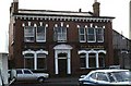
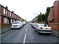
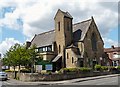
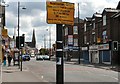
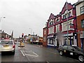
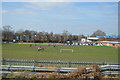


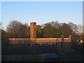
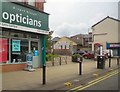
100 photos from this area
Area Information
Key information about the M12 5ST including its size, population, and administrative classification.
- Area Type
- Postcode
- Area Size
- 4777 m²
- Population
- 1732
- Population Density
- 9135 people/km²
House Prices in M12 5ST
21
Properties
£87,925
Average Sold Price
£21,000
Lowest Price
£185,000
Highest Price
Showing 21 properties
| Address | Type | Beds | Baths | Last Sale Price | Last Sale Date | |
|---|---|---|---|---|---|---|
| 68 Hemmons Road, Manchester, M12 5ST | Semi-detached | 3 | 1 | £185,000 | Mar 2021 | |
| 65 Hemmons Road, Manchester, M12 5ST | Semi-detached | 3 | 1 | £170,000 | Sep 2020 | |
| 75 Hemmons Road, Manchester, M12 5ST | Semi-detached | 3 | 1 | £170,000 | Mar 2020 | |
| 76 Hemmons Road, Manchester, M12 5ST | house | - | - | £102,000 | Nov 2018 | |
| 66 Hemmons Road, Manchester, M12 5ST | Terraced | 3 | - | £120,000 | Mar 2016 | |
| 86 Hemmons Road, Manchester, M12 5ST | Terraced | 2 | 2 | £78,000 | Mar 2011 | |
| 82 Hemmons Road, Manchester, M12 5ST | house | 3 | 1 | £90,000 | Sep 2007 | |
| 84 Hemmons Road, Manchester, M12 5ST | house | - | - | £60,000 | Dec 2005 | |
| 72 Hemmons Road, Manchester, M12 5ST | Terraced | 3 | 1 | £69,000 | Aug 2005 | |
| 70 Hemmons Road, Manchester, M12 5ST | Semi-detached | - | - | £64,950 | Dec 2002 |
Page 1 of 3
Energy Efficiency in M12 5ST
Amenities
Schools
| Rank | School | Type | Entry gender | Ages |
|---|
Explore more schools in this area
Go to Schools tabDemographics
Household Size
Family (3-5 people)
most common
Accommodation Type
Houses
most common
Tenure
39
majority
Ethnic Group
asian_total
most common
Religion
N/A
most common
Household Composition
N/A
most common
Age
22
median
Adults (30-64 years)
most common
Household Deprivation
N/A
with no deprivation
NS-SEC
12
in Lower managerial occupations
Explore more demographic insights in this area
Go to Demographics tabPlanning
Planning Constraints
- Flood RiskPremium
- Ramsar Wetland SitesPremium
- Area of Outstanding Natural BeautyPremium
- Protected Nature ReservePremium
- Protected WoodlandPremium