Area Overview for M12 5BH
Photos of M12 5BH


Area Information
Living in M12 5BH means being part of a small, tightly knit residential cluster in England with a population of 1792. This area is characterised by its compact size and proximity to key urban amenities. The community here is predominantly adults aged 30–64, reflecting a mature demographic. While the area lacks sprawling suburbs, it offers a focused living environment with nearby rail and metro links. Daily life is shaped by the mix of retail and transport hubs within reach, including multiple supermarkets and railway stations. The postcode is not a sprawling suburb but a defined cluster, which means residents are likely to know their neighbours. The presence of a high-scoring primary school adds to its appeal for families, though the area’s small size means its housing stock is limited. For those seeking a quiet, manageable community with direct access to urban infrastructure, M12 5BH provides a distinct balance of residential and practical living.
- Area Type
- Postcode
- Area Size
- Not available
- Population
- 1792
- Population Density
- 2078 people/km²
The property market in M12 5BH is shaped by its small size and 14% home ownership rate, which implies that the majority of housing is rented out. The accommodation type is primarily houses, a rarity in such a compact postcode area. This suggests a mix of older, individual properties rather than high-density housing. For buyers, this means the area is not a traditional owner-occupied market but one where rental demand may dominate. The limited number of properties available could make it challenging for buyers seeking a long-term investment, particularly given the small geographical footprint. The presence of houses rather than flats or apartments may appeal to those prioritising space, though the low home ownership rate indicates that landowners may be more likely to lease than sell. Prospective buyers should consider the area’s limited scale and the dominance of rental properties when evaluating its potential.
House Prices in M12 5BH
No properties found in this postcode.
Energy Efficiency in M12 5BH
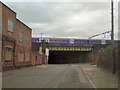
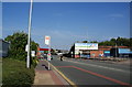
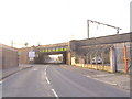
Residents of M12 5BH have access to a range of amenities within practical reach, including five retail stores like Tesco Beswick and Asda Longsight, which cater to everyday shopping needs. The area’s proximity to metro stations such as Velopark and Etihad Campus provides easy access to leisure and transport hubs. Five railway stations, including Ashburys and Belle Vue, offer connections to broader urban networks. A single bus stop at Chorlton Street Coach Station adds flexibility for local travel. While the data does not specify dining or park options, the presence of multiple retail and transport points suggests a functional, convenience-driven lifestyle. The area’s small size means amenities are compact, but the variety of retail and transport options ensures daily life is efficient. For those prioritising accessibility, M12 5BH offers a mix of practicality and connectivity.
Amenities
Schools
The nearest school to M12 5BH is Armitage CofE Primary School, which has an outstanding Ofsted rating. This is the only school listed in the data, meaning families in the area rely on this single primary school for early education. The school’s high rating suggests quality teaching and facilities, which is a significant advantage for parents. However, the absence of secondary schools or additional educational institutions within the area may require families to travel further for higher education. The single school also means that the community’s educational needs are concentrated in one institution, which could be both a strength—ensuring focused resources—and a limitation if the school reaches capacity. For those prioritising strong primary education, Armitage CofE Primary School is a clear positive, but secondary schooling options are not covered in the data.
| Rank | School | Type | Entry gender | Ages |
|---|
Explore more schools in this area
Go to Schools tabDemographics
The population of M12 5BH is 1792, with a median age of 47, indicating a mature community. The most common age range is adults aged 30–64, suggesting a stable, established population. Home ownership here is low at 14%, meaning most residents are likely to be renters. The accommodation type is predominantly houses, which is unusual for a small postcode area, hinting at a mix of older properties. The predominant ethnic group is Black, reflecting a specific demographic profile. This data suggests a community that is not heavily reliant on homeownership and may have a higher proportion of transient or rental-focused households. The low home ownership rate could impact long-term investment potential, though it also indicates a flexible housing market. The area’s demographic makeup is distinct, with no data suggesting significant diversity beyond the Black population.
Household Size
Accommodation Type
Tenure
Ethnic Group
Religion
Household Composition
Age
Household Deprivation
NS-SEC
Explore more demographic insights in this area
Go to Demographics tabPlanning
Planning Constraints
- Flood RiskPremium
- Ramsar Wetland SitesPremium
- Area of Outstanding Natural BeautyPremium
- Protected Nature ReservePremium
- Protected WoodlandPremium