Area Overview for M12 4WB
Photos of M12 4WB
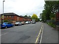
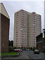
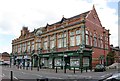
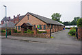

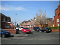
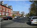

42 photos from this area
Area Information
Key information about the M12 4WB including its size, population, and administrative classification.
- Area Type
- Postcode
- Area Size
- 2.4 hectares
- Population
- 1926
- Population Density
- 2166 people/km²
House Prices in M12 4WB
51
Properties
£101,812
Average Sold Price
£19,500
Lowest Price
£180,000
Highest Price
Showing 51 properties
| Address | Type | Beds | Baths | Last Sale Price | Last Sale Date | |
|---|---|---|---|---|---|---|
| 74 Kirkmanshulme Lane, Manchester, M12 4WB | house | 3 | 1 | £180,000 | Feb 2025 | |
| 82 Kirkmanshulme Lane, Manchester, M12 4WB | Terraced | 3 | 2 | £175,000 | Mar 2019 | |
| 94 Kirkmanshulme Lane, Manchester, M12 4WB | house | - | - | £115,000 | Aug 2017 | |
| 96 Kirkmanshulme Lane, Manchester, M12 4WB | Semi-detached | 3 | 1 | £105,000 | Oct 2016 | |
| 122 Kirkmanshulme Lane, Manchester, M12 4WB | Terraced | 3 | 2 | £102,500 | Feb 2015 | |
| 98 Kirkmanshulme Lane, Manchester, M12 4WB | house | 3 | - | £90,000 | Jan 2014 | |
| 130 Kirkmanshulme Lane, Manchester, M12 4WB | house | 3 | - | £104,000 | Nov 2010 | |
| 72A Kirkmanshulme Lane, Manchester, M12 4WB | house | - | - | £105,000 | Nov 2008 | |
| 80 Kirkmanshulme Lane, Manchester, M12 4WB | Terraced | - | - | £135,000 | Dec 2006 | |
| 114 KIRKMANSHULME LANE, Manchester, M12 4WB | Detached | 1 | 1 | £175,000 | Aug 2004 |
Page 1 of 6
Energy Efficiency in M12 4WB
Amenities
Schools
| Rank | School | Type | Entry gender | Ages |
|---|
Explore more schools in this area
Go to Schools tabDemographics
Household Size
Family (3-5 people)
most common
Accommodation Type
Houses
most common
Tenure
38
majority
Ethnic Group
asian_total
most common
Religion
N/A
most common
Household Composition
N/A
most common
Age
47
median
Adults (30-64 years)
most common
Household Deprivation
N/A
with no deprivation
NS-SEC
18
in Lower managerial occupations
Explore more demographic insights in this area
Go to Demographics tabPlanning
Planning Constraints
- Flood RiskPremium
- Ramsar Wetland SitesPremium
- Area of Outstanding Natural BeautyPremium
- Protected Nature ReservePremium
- Protected WoodlandPremium