Area Overview for M12 4DX
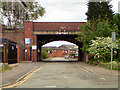
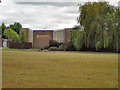
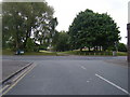
Photos of M12 4DX


Area Information
Living in M12 4DX means being part of a small, defined residential cluster in England, home to 1,803 people. This postcode area is characterised by its compact size and proximity to essential services. The community here is predominantly composed of adults aged 30–64, with a median age of 47, suggesting a mature, stable population. The area’s housing stock is largely made up of houses, reflecting a traditional suburban layout. Daily life is shaped by nearby amenities, including retail outlets like Asda Longsight and Tesco Manchester, as well as robust transport links via rail and metro stations such as Ardwick and Belle Vue. While the area lacks large-scale infrastructure, its practical reach includes schools, shops, and public transport, offering a functional, no-frills lifestyle. The presence of both primary and special schools indicates a focus on education, though families may need to consider specific needs when choosing a school. M12 4DX is not a sprawling suburb but a tight-knit cluster where proximity to services and transport is a key feature.
- Area Type
- Postcode
- Area Size
- Not available
- Population
- 1803
- Population Density
- 6720 people/km²
The property market in M12 4DX is shaped by a low home ownership rate of 23%, indicating that most residents rent rather than own their homes. The area’s housing stock is primarily composed of houses, which is atypical for inner-city postcodes but suggests a more spread-out, suburban layout. This mix may appeal to buyers seeking single-family homes, though the small size of the area means competition for properties could be limited. The low ownership rate implies a reliance on rental markets, which may affect long-term investment potential. For buyers, the focus should be on nearby areas with similar characteristics, as M12 4DX itself offers limited housing options. The presence of houses rather than flats or apartments may also influence demand from families or those prioritising space. However, the area’s compact nature means buyers must weigh the benefits of proximity to services against the constraints of a small, possibly saturated market.
House Prices in M12 4DX
No properties found in this postcode.
Energy Efficiency in M12 4DX
The lifestyle in M12 4DX is shaped by its proximity to essential amenities. Retail options include five notable venues such as Asda Longsight, Farmfoods Longsight, and Tesco Manchester, providing everyday shopping convenience. The area’s transport links, including rail and metro stations, facilitate easy access to leisure, work, and cultural activities beyond the immediate postcode. While specific parks or recreational spaces are not detailed in the data, the presence of schools and community hubs suggests a focus on family-oriented living. The limited bus network means residents may rely more on walking, cycling, or public transport for local errands. Overall, the area offers a practical, functional lifestyle with a balance of retail, transport, and educational resources, though its compact size means residents may need to venture slightly further for broader amenities.
Amenities
Schools
Residents of M12 4DX have access to a range of educational institutions, including St Luke’s CofE Primary School, which holds a ‘good’ Ofsted rating. This school serves younger children, offering a foundation for primary education. For specialist needs, Longsight Park School and Richmond Park School cater to students with special educational requirements, though their Ofsted ratings are not specified. The Manchester Key Stage 3 PRU is another option, designed for students with complex needs. Additionally, the Dean Trust Ardwick academy also holds a ‘good’ Ofsted rating, providing secondary-level education. The mix of school types suggests the area can accommodate diverse educational preferences, from mainstream to specialist provision. However, families must verify whether specific schools meet their children’s needs, as the absence of detailed ratings for some institutions may require further research.
| Rank | School | Type | Entry gender | Ages |
|---|
Explore more schools in this area
Go to Schools tabDemographics
The population of M12 4DX is 1,803, with a median age of 47, reflecting a community of middle-aged adults. The most common age range is 30–64 years, indicating a mature demographic profile. Home ownership in the area is low, with only 23% of households owning their homes, suggesting a rental market dominates. The primary accommodation type is houses, which is unusual for urban areas, hinting at a suburban or semi-rural character. The predominant ethnic group is Asian, though specific subgroups are not detailed. This diversity may influence cultural dynamics and community cohesion. The low home ownership rate could imply economic pressures or a transient population, but it also means the area may cater to renters seeking stability. The absence of detailed deprivation data means it is unclear how this affects quality of life, though the presence of schools and amenities suggests basic needs are met.
Household Size
Accommodation Type
Tenure
Ethnic Group
Religion
Household Composition
Age
Household Deprivation
NS-SEC
Explore more demographic insights in this area
Go to Demographics tabPlanning
Planning Constraints
- Flood RiskPremium
- Ramsar Wetland SitesPremium
- Area of Outstanding Natural BeautyPremium
- Protected Nature ReservePremium
- Protected WoodlandPremium