Area Overview for M11 3WW
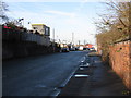
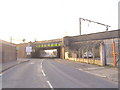
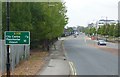
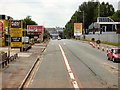
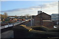
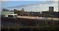
Photos of M11 3WW


Area Information
Living in M11 3WW means being part of a small, tightly knit residential cluster in England, home to 2,955 residents. This area is characterised by its mature demographic, with a median age of 47 and a strong presence of adults aged 30–64. The community feels settled, with a focus on stability and established living. While the area is compact, it is well-connected to nearby urban hubs through rail and metro links, offering access to broader opportunities. Daily life here balances suburban tranquillity with proximity to essential services. The housing stock is predominantly houses, reflecting a preference for family-friendly living. Residents benefit from excellent broadband connectivity, rated 97 out of 100, ensuring seamless digital experiences. However, the area’s small size means it is best suited for those prioritising convenience over sprawling landscapes. For buyers, M11 3WW offers a snapshot of a community where practicality meets a sense of place, though its limited scale demands careful consideration of long-term needs.
- Area Type
- Postcode
- Area Size
- Not available
- Population
- 2955
- Population Density
- 5248 people/km²
The property market in M11 3WW is defined by its low home ownership rate of 38%, indicating that the majority of residents are renters rather than homeowners. The accommodation type is predominantly houses, which are less common in high-density urban areas. This suggests a market skewed towards rental properties, with limited availability of owner-occupied homes. The small size of the area means that the housing stock is not expansive, and buyers should consider the limited scope for property diversity. The presence of houses rather than flats may appeal to those seeking larger living spaces, but the low home ownership rate implies competition for available properties. Given the area’s compact nature, buyers should also factor in the proximity to surrounding zones for more options. The market remains niche, with prices and availability likely influenced by broader regional trends in Manchester.
House Prices in M11 3WW
No properties found in this postcode.
Energy Efficiency in M11 3WW
The lifestyle in M11 3WW is shaped by its proximity to retail hubs and transport networks. Residents can access major supermarkets like Tesco Beswick and Asda Eastlands, ensuring everyday shopping needs are met. The area’s rail and metro links connect it to key destinations, including the Etihad Campus and Velopark, which may offer leisure and recreational opportunities. While the data does not specify parks or leisure facilities, the presence of multiple transport stops suggests a focus on accessibility over local amenities. The single bus stop at Chorlton Street Coach Station provides limited public transport, but the rail network compensates with frequent services. The area’s character is defined by its practicality, with a balance between suburban comfort and urban connectivity. For those prioritising convenience over extensive green spaces, M11 3WW offers a functional lifestyle with minimal effort required to access services.
Amenities
Schools
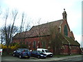
Residents of M11 3WW have access to several primary schools, including Ashbury Community Primary School, St Brigid’s RC Primary School (rated ‘good’ by Ofsted), and Ashbury Meadow Primary School (rated ‘satisfactory’). The East Manchester Academy, an academy school, is also nearby, though it lacks an Ofsted rating in the data. This mix of school types offers families a range of options, from faith-based education at St Brigid’s to more general provision at the academy. The presence of multiple primary schools within practical reach is a key advantage for families, though the ratings suggest variability in educational quality. Parents may need to assess individual school performance beyond the listed data. The lack of secondary school information means further research is required for older children, but the primary options provide a foundation for early education.
| Rank | School | Type | Entry gender | Ages |
|---|
Explore more schools in this area
Go to Schools tabDemographics
The population of M11 3WW is 2,955, with a median age of 47, indicating a community of middle-aged adults. Over 60% of residents fall within the 30–64 age range, suggesting a focus on established families and professionals. Home ownership is relatively low at 38%, with the majority of properties being houses rather than flats or apartments. The predominant ethnic group is White, reflecting a homogenous demographic profile. This age structure and ownership pattern suggest a community where many residents have long-term ties to the area. The absence of specific data on deprivation means it is difficult to assess broader quality-of-life factors, but the age profile implies a population prioritising stability over mobility. The lack of diversity in ethnicity and household composition may influence local social dynamics and service provision, though this remains unquantified in the data.
Household Size
Accommodation Type
Tenure
Ethnic Group
Religion
Household Composition
Age
Household Deprivation
NS-SEC
Explore more demographic insights in this area
Go to Demographics tabPlanning
Planning Constraints
- Flood RiskPremium
- Ramsar Wetland SitesPremium
- Area of Outstanding Natural BeautyPremium
- Protected Nature ReservePremium
- Protected WoodlandPremium