Area Overview for M11 3NL
Photos of M11 3NL

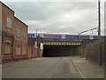
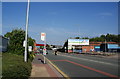
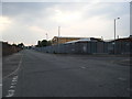
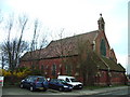
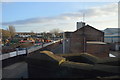
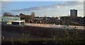

84 photos from this area
Area Information
Key information about the M11 3NL including its size, population, and administrative classification.
- Area Type
- Postcode
- Area Size
- 7866 m²
- Population
- 2955
- Population Density
- 5248 people/km²
House Prices in M11 3NL
24
Properties
£190,256
Average Sold Price
£34,500
Lowest Price
£301,000
Highest Price
Showing 24 properties
| Address | Type | Beds | Baths | Last Sale Price | Last Sale Date | |
|---|---|---|---|---|---|---|
| 40 Paxton Place, Manchester, M11 3NL | Terraced | 4 | 2 | £290,000 | Aug 2025 | |
| 32 Paxton Place, Manchester, M11 3NL | Retail | 3 | 2 | £301,000 | Jun 2022 | |
| 26 Paxton Place, Manchester, M11 3NL | Retail | 3 | 1 | £286,000 | Jun 2022 | |
| 34 Paxton Place, Manchester, M11 3NL | Terraced | 3 | 2 | £230,000 | Jan 2021 | |
| 20 Paxton Place, Manchester, M11 3NL | Semi-detached | 3 | 2 | £170,000 | Aug 2018 | |
| 38 Paxton Place, Manchester, M11 3NL | Terraced | 3 | - | £195,000 | Jul 2018 | |
| 18 Paxton Place, Manchester, M11 3NL | Terraced | 3 | 2 | £180,000 | Apr 2017 | |
| 35 Paxton Place, Manchester, M11 3NL | Terraced | 3 | - | £155,000 | May 2016 | |
| 16 Paxton Place, Manchester, M11 3NL | Semi-detached | 3 | 2 | £163,424 | Dec 2015 | |
| 22 Paxton Place, Manchester, M11 3NL | Terraced | 3 | 2 | £158,500 | Aug 2015 |
Page 1 of 3
Energy Efficiency in M11 3NL
Amenities
Schools
| Rank | School | Type | Entry gender | Ages |
|---|
Explore more schools in this area
Go to Schools tabDemographics
Household Size
Family (3-5 people)
most common
Accommodation Type
Houses
most common
Tenure
38
majority
Ethnic Group
White
most common
Religion
N/A
most common
Household Composition
N/A
most common
Age
47
median
Adults (30-64 years)
most common
Household Deprivation
N/A
with no deprivation
NS-SEC
30
in Lower managerial occupations
Explore more demographic insights in this area
Go to Demographics tabPlanning
Planning Constraints
- Flood RiskPremium
- Ramsar Wetland SitesPremium
- Area of Outstanding Natural BeautyPremium
- Protected Nature ReservePremium
- Protected WoodlandPremium