Area Overview for M11 3EL
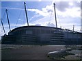
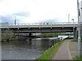
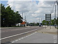
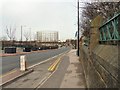
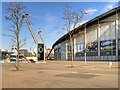
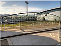
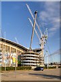
Photos of M11 3EL


Area Information
M11 3EL is a small residential cluster in England, home to 1426 residents. Its compact size suggests a close-knit community, where daily life is shaped by proximity to essential services and local amenities. The area’s character is defined by its practical layout, with homes likely designed for convenience rather than grandeur. Residents benefit from a mix of nearby schools, retail outlets, and transport links, making it a viable choice for those seeking accessibility without the bustle of larger cities. While the area’s population is modest, it supports a range of services, including primary and special education, which cater to diverse family needs. The surrounding environment appears to be functional, with no significant natural constraints like protected woodlands or wetlands. However, the area’s safety profile is a concern, with a high crime risk reported. For buyers, this means considering security measures as part of any property decision. Despite this, the area’s proximity to metro hubs, rail stations, and retail centres offers a balance of urban connectivity and residential tranquillity. Living in M11 3EL is about practicality, with a focus on accessible living and community-based amenities.
- Area Type
- Postcode
- Area Size
- Not available
- Population
- 1426
- Population Density
- 1782 people/km²
The property market in M11 3EL reflects its small scale and residential focus. With a population of 1426, the housing stock is likely limited to a mix of owner-occupied homes and rental properties, though specific ownership percentages are not provided. The area’s compact nature suggests a predominance of smaller dwellings, such as terraced houses or flats, catering to families and individuals seeking manageable living spaces. Given the lack of major planning constraints, development may be relatively straightforward, though the high crime risk could influence buyer perceptions. For those considering the area, the property market is likely to be niche, with limited inventory and competition. Buyers should assess the balance between affordability and security, as the area’s practical amenities may offset concerns about safety. Proximity to transport links and retail hubs adds value, but the small size means that immediate surroundings are critical to overall quality of life.
House Prices in M11 3EL
No properties found in this postcode.
Energy Efficiency in M11 3EL
Residents of M11 3EL have access to a range of amenities within practical reach. Retail options include major supermarkets like Tesco Beswick, Asda Eastlands, and Sainsburys Manchester, ensuring convenience for daily shopping. The area’s proximity to metro hubs such as Etihad Campus, Holt Town, and Velopark adds recreational and commercial opportunities. For transport, five rail stations and a bus coach station provide flexibility for commuting or leisure travel. While the area lacks extensive green spaces or parks, the absence of protected natural sites suggests that development has prioritised residential and commercial needs. The lifestyle here is practical, with an emphasis on accessibility and local services. However, the small size of the area means that residents may need to travel further for specialised amenities. Overall, M11 3EL offers a functional, community-oriented environment with a focus on connectivity and everyday convenience.
Amenities
Schools
Residents of M11 3EL have access to two notable schools within practical reach. CofE School of the Resurrection is a primary school with a Good Ofsted rating, offering a solid foundation for younger children. Nearby, One City Schools provides special education services, addressing the needs of students with specific learning requirements. This combination of school types ensures that families can find both mainstream and specialist education options. The presence of a primary school suggests a focus on early years education, while the special school caters to a more niche demographic. For parents, this mix may be advantageous, offering flexibility depending on their children’s needs. However, the absence of secondary schools in the immediate area could mean longer commutes for older students. Overall, the educational landscape in M11 3EL supports a range of academic and developmental pathways, though further research would be needed for comprehensive school comparisons.
| Rank | School | Type | Entry gender | Ages |
|---|
Explore more schools in this area
Go to Schools tabDemographics
Household Size
Accommodation Type
Tenure
Ethnic Group
Religion
Household Composition
Age
Household Deprivation
NS-SEC
Explore more demographic insights in this area
Go to Demographics tabPlanning
Planning Constraints
- Flood RiskPremium
- Ramsar Wetland SitesPremium
- Area of Outstanding Natural BeautyPremium
- Protected Nature ReservePremium
- Protected WoodlandPremium