Area Overview for M11 2WB
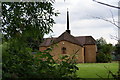
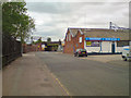
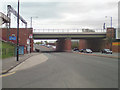
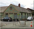
Photos of M11 2WB


Area Information
Living in M11 2WB means inhabiting a tightly packed residential cluster in England, where 2,334 people reside across a densely populated area of 2269 people per square kilometre. This small postcode area is defined by its proximity to essential services and transport links, making it practical for daily life. The community is characterised by a mix of houses, with a notable 23% home ownership rate, suggesting many residents rent. Daily life here is shaped by nearby schools, retail hubs, and rail networks, creating a compact environment where amenities are within easy reach. The area’s small size means residents are close to key destinations, though its density can influence local dynamics. For those prioritising convenience over space, M11 2WB offers a focused living experience, with a balance of residential and commercial infrastructure. The area’s distinctiveness lies in its accessibility and the presence of multiple educational institutions, which cater to a range of age groups and needs.
- Area Type
- Postcode
- Area Size
- Not available
- Population
- 2334
- Population Density
- 2269 people/km²
The property market in M11 2WB is shaped by its 23% home ownership rate, which is significantly lower than the national average. This suggests the area is primarily a rental market, with many residents living in rented houses. The accommodation type is predominantly houses, which is unusual for a high-density postcode area. This mix of high population density and house-based housing stock may indicate a focus on family homes, though the low ownership rate could reflect affordability challenges or a transient population. For buyers, the limited home ownership suggests competition for available properties, with potential for rental income if purchasing. The area’s small size means the immediate surroundings are critical for property seekers, with nearby amenities influencing desirability. The presence of multiple schools and transport links may enhance the area’s appeal, despite its compact nature.
House Prices in M11 2WB
No properties found in this postcode.
Energy Efficiency in M11 2WB
Residents of M11 2WB enjoy a lifestyle shaped by nearby amenities that cater to daily needs. The area’s retail options include major supermarkets like Tesco Beswick, Asda Eastlands, and Aldi Gorton, ensuring easy access to groceries and household essentials. For leisure, the Etihad Campus and Velopark metro stations offer proximity to sports and entertainment venues. The rail network, with stations such as Ashburys and Belle Vue, provides quick access to cultural and commercial hubs in Manchester. The compact nature of the area means amenities are within walking or short transit distance, enhancing convenience. While the data does not specify parks or dining options, the presence of multiple retail and transport hubs suggests a practical, service-oriented lifestyle. This focus on accessibility and proximity to key services makes M11 2WB suitable for those prioritising efficiency over expansive living spaces.
Amenities
Schools
Residents of M11 2WB have access to a range of educational institutions, including primary, sixth-form, and special schools. St Barnabas’ CofE Primary School and St Barnabas CofE Primary Academy cater to younger children, with the latter holding a ‘good’ Ofsted rating. The Manchester College and LTE Group provide sixth-form education, while Bridge College specialises in special needs education. This mix of school types ensures families can find options for different age groups and learning requirements. The proximity of multiple schools within practical reach reduces commuting time for students and parents. The presence of both mainstream and specialist institutions suggests the area supports diverse educational needs, though no data on school performance beyond Ofsted ratings is available. For families prioritising school quality, the ‘good’ rating at St Barnabas CofE Primary Academy is a positive indicator.
| Rank | School | Type | Entry gender | Ages |
|---|
Explore more schools in this area
Go to Schools tabDemographics
The population of M11 2WB has a median age of 47, with the majority of residents aged 30–64. This suggests a mature, stable community, likely with families and professionals. Only 23% of homes are owner-occupied, indicating a rental-heavy market. The area is predominantly composed of houses, which is uncommon in high-density urban settings. The predominant ethnic group is White, though no specific data on diversity or deprivation levels is provided. The absence of detailed diversity metrics means the community’s composition remains partially undefined. For quality of life, the low home ownership rate may imply limited long-term investment opportunities, though the presence of schools and transport links could offset this. The age profile suggests a need for services catering to older adults and families, which the area appears to accommodate through its mix of educational and retail amenities.
Household Size
Accommodation Type
Tenure
Ethnic Group
Religion
Household Composition
Age
Household Deprivation
NS-SEC
Explore more demographic insights in this area
Go to Demographics tabPlanning
Planning Constraints
- Flood RiskPremium
- Ramsar Wetland SitesPremium
- Area of Outstanding Natural BeautyPremium
- Protected Nature ReservePremium
- Protected WoodlandPremium