Area Overview for M11 1AU
Photos of M11 1AU
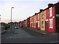
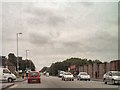

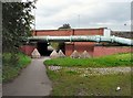
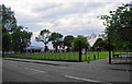
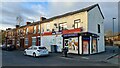
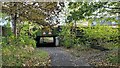
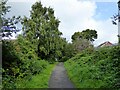
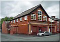
44 photos from this area
Area Information
Key information about the M11 1AU including its size, population, and administrative classification.
- Area Type
- Postcode
- Area Size
- 5058 m²
- Population
- 1486
- Population Density
- 3333 people/km²
House Prices in M11 1AU
30
Properties
£56,528
Average Sold Price
£3,300
Lowest Price
£151,500
Highest Price
Showing 30 properties
| Address | Type | Beds | Baths | Last Sale Price | Last Sale Date | |
|---|---|---|---|---|---|---|
| 84 Harley Street, Manchester, M11 1AU | Terraced | 2 | 1 | £110,000 | Jun 2023 | |
| 120 Harley Street, Manchester, M11 1AU | house | 2 | 1 | £151,500 | Oct 2022 | |
| 114 Harley Street, Manchester, M11 1AU | house | 2 | 1 | £117,500 | Sep 2022 | |
| 64 Harley Street, Manchester, M11 1AU | Terraced | 2 | 1 | £76,000 | Jan 2022 | |
| 80 Harley Street, Manchester, M11 1AU | Terraced | 2 | 1 | £89,000 | Aug 2021 | |
| 82 Harley Street, Manchester, M11 1AU | Terraced | 2 | 1 | £98,000 | Mar 2020 | |
| 116 Harley Street, Manchester, M11 1AU | house | - | - | £60,000 | May 2018 | |
| 128 Harley Street, Manchester, M11 1AU | Terraced | 3 | 1 | £63,000 | Mar 2016 | |
| 78 Harley Street, Manchester, M11 1AU | Terraced | 3 | 1 | £84,500 | Oct 2015 | |
| 76 Harley Street, Manchester, M11 1AU | house | - | - | £52,000 | Apr 2010 |
Page 1 of 3
Energy Efficiency in M11 1AU
Amenities
Schools
| Rank | School | Type | Entry gender | Ages |
|---|
Explore more schools in this area
Go to Schools tabDemographics
Household Size
Family (3-5 people)
most common
Accommodation Type
Houses
most common
Tenure
35
majority
Ethnic Group
White
most common
Religion
N/A
most common
Household Composition
N/A
most common
Age
47
median
Adults (30-64 years)
most common
Household Deprivation
N/A
with no deprivation
NS-SEC
20
in Lower managerial occupations
Explore more demographic insights in this area
Go to Demographics tabPlanning
Planning Constraints
- Flood RiskPremium
- Ramsar Wetland SitesPremium
- Area of Outstanding Natural BeautyPremium
- Protected Nature ReservePremium
- Protected WoodlandPremium