Area Overview for M10 0ER
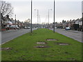
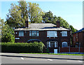
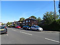
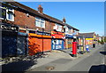
Photos of M10 0ER


Area Information
Living in M10 0ER means being part of a small, tightly knit residential cluster in England, home to 2,234 residents. This area is defined by its compact nature, with homes predominantly in the form of individual properties rather than flats. The community is largely composed of adults aged 30–64, reflecting a mature demographic with established roots. Daily life here is shaped by proximity to key amenities, including multiple rail stations, retail outlets, and educational institutions. The area’s small size means residents can access essential services within a short distance, though its limited scale also means it is not a sprawling suburb. M10 0ER sits at the intersection of practicality and quiet living, with no major natural or protected sites nearby. For those seeking a balance between convenience and a sense of place, this postcode offers a straightforward, no-frills lifestyle. The absence of environmental constraints and the presence of reliable transport links make it a viable choice for commuters and families alike.
- Area Type
- Postcode
- Area Size
- Not available
- Population
- 2234
- Population Density
- 6983 people/km²
The property market in M10 0ER is characterised by a 46% home ownership rate, with houses forming the majority of the housing stock. This suggests a market where owner-occupation is less common than renting, potentially driven by the area’s modest size and limited new development. The presence of individual homes rather than flats or apartments indicates a preference for traditional, single-family living. For buyers, this means a smaller pool of available properties, with competition likely focused on existing homes rather than new builds. The low home ownership rate may also reflect economic factors, such as affordability challenges or a reliance on rental income. Given the area’s compact nature, property values are unlikely to be influenced by speculative investment, making it a stable but niche market for those seeking a specific type of housing. Buyers should consider the limited availability of properties and the potential for long-term tenancy in the area.
House Prices in M10 0ER
No properties found in this postcode.
Energy Efficiency in M10 0ER
The lifestyle in M10 0ER is shaped by its proximity to a range of amenities, including retail, transport, and community hubs. Residents have access to major supermarkets like Morrisons New and Aldi Failsworth, as well as Costco Oldham, ensuring grocery shopping is convenient. The area’s rail and metro stations, such as Moston and Failsworth, provide easy access to employment, leisure, and social opportunities beyond the immediate postcode. While the data does not specify parks or recreational spaces, the presence of multiple transport links suggests the area is integrated into a larger network of amenities. The single bus stop at Chorlton Street Coach Station adds to the connectivity, though the overall character of the area leans towards practicality over expansive leisure options. For those prioritising accessibility and routine convenience, M10 0ER offers a straightforward, functional lifestyle.
Amenities
Schools
The nearest schools to M10 0ER include St Matthew’s RC High School, which operates as both a primary school and an academy with a good Ofsted rating. This dual designation means the school serves multiple age groups, offering a continuous educational pathway for families. The good Ofsted rating indicates a satisfactory standard of teaching and facilities, though it does not suggest excellence. For parents, the presence of a single school with a broad age range may reduce the need to navigate multiple institutions, though it also limits choice. The data does not mention additional schools, so families relying on a range of educational options may need to look beyond the immediate area. The school’s performance is a key factor in the area’s appeal, particularly for those prioritising established, locally based education.
| Rank | School | Type | Entry gender | Ages |
|---|
Explore more schools in this area
Go to Schools tabDemographics
The population of M10 0ER is 2,234, with a median age of 47, indicating a community skewed towards middle-aged and older residents. The most common age range is 30–64 years, suggesting a stable, working-age population. Home ownership here is relatively low at 46%, which implies a higher proportion of renters compared to owner-occupied homes. The predominant accommodation type is houses, reflecting a more traditional housing stock rather than high-density living. The area’s demographic profile is largely homogenous, with the White ethnic group forming the majority. This composition shapes a community with established social networks and a focus on long-term residency. The lack of specific data on deprivation means that quality of life assessments must rely on the available figures, such as the 46% home ownership rate, which may influence local economic dynamics and housing affordability.
Household Size
Accommodation Type
Tenure
Ethnic Group
Religion
Household Composition
Age
Household Deprivation
NS-SEC
Explore more demographic insights in this area
Go to Demographics tabPlanning
Planning Constraints
- Flood RiskPremium
- Ramsar Wetland SitesPremium
- Area of Outstanding Natural BeautyPremium
- Protected Nature ReservePremium
- Protected WoodlandPremium