Area Overview for M1 5QB
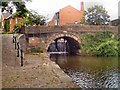
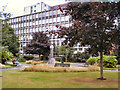
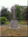
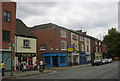
Photos of M1 5QB


Area Information
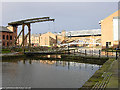
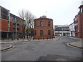
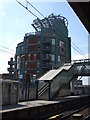
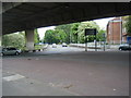
Living in M1 5QB means being part of a small, tightly knit residential cluster in England’s north-west. With a population of 2014, the area is compact but strategically positioned near major transport routes and urban hubs. The community here is young, with a median age of 22 and most residents aged between 15 and 29. This demographic shapes the area’s character: it is a place of transient living, with many residents renting rather than owning. Daily life is defined by proximity to public transport, with five railway stations within reach, including Manchester Oxford Road and Salford Central. The area’s small size means amenities are concentrated, from retail outlets like Sainsburys Whitworth to nearby metro stops at St Peter’s Square. While it lacks natural landscapes, its urban connectivity makes it appealing for those prioritising convenience over green space. M1 5QB is not a place for those seeking seclusion; it thrives on accessibility, making it a practical choice for commuters and students.
- Area Type
- Postcode
- Area Size
- Not available
- Population
- 2014
- Population Density
- 13890 people/km²
The property market in M1 5QB is characterised by a low home ownership rate of 17%, with flats making up the majority of accommodation. This suggests the area is not a traditional owner-occupied neighbourhood but rather a rental-focused zone. The prevalence of flats indicates a compact, urban layout, typical of areas near major transport links. For buyers, this means limited opportunities to purchase owner-occupied properties, with most available homes likely to be rented out. The small size of the area means the immediate surroundings are crucial for property seekers, as the local housing stock is unlikely to expand significantly. Those interested in buying should consider the transient nature of the market and the potential for competition from renters looking for long-term leases.
House Prices in M1 5QB
No properties found in this postcode.
Energy Efficiency in M1 5QB
Residents of M1 5QB have access to a range of amenities within walking or short transit distance. Retail options include Sainsburys Whitworth, Spar, and Sainsburys Manchester, ensuring everyday shopping needs are met. The area’s transport links also grant easy access to leisure spots like Piccadilly Gardens and Market Street, which offer green spaces and cultural attractions. The presence of five metro stops, including St Peter’s Square, enhances mobility, making it simple to reach dining, entertainment, and other services in Manchester. While the area lacks large parks or natural landscapes, its urban layout prioritises convenience over expansive open spaces. The combination of retail, transport, and proximity to the city centre creates a lifestyle focused on accessibility, appealing to those who value efficiency in daily routines.
Amenities
Schools
| Rank | School | Type | Entry gender | Ages |
|---|
Explore more schools in this area
Go to Schools tabDemographics
The population of M1 5QB is overwhelmingly young, with a median age of 22 and 17% of residents owning their homes. The majority of the population falls within the 15–29 age range, reflecting a community shaped by students, graduates, and young professionals. Home ownership is low, with flats being the predominant accommodation type. This suggests a rental market dominates, likely driven by students or those in transient employment. The predominant ethnic group is White, though specific data on diversity is not provided. The low home ownership rate may indicate limited long-term investment in property, which could affect housing stability. For those considering relocation, the area’s youthful demographic means a dynamic, fast-paced environment, but also potential challenges in finding long-term housing.
Household Size
Accommodation Type
Tenure
Ethnic Group
Religion
Household Composition
Age
Household Deprivation
NS-SEC
Explore more demographic insights in this area
Go to Demographics tabPlanning
Planning Constraints
- Flood RiskPremium
- Ramsar Wetland SitesPremium
- Area of Outstanding Natural BeautyPremium
- Protected Nature ReservePremium
- Protected WoodlandPremium