Area Overview for M1 2WU
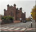
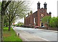
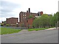
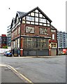
Photos of M1 2WU


Area Information
Living in M1 2WU means being part of a small, tightly knit residential cluster in Manchester, England. With a population of 1,691, this area is compact yet well-connected to the city’s broader infrastructure. The community is young, with a median age of 22, and dominated by individuals aged 15–29. This demographic shapes daily life, with a focus on convenience, transport links, and proximity to the University of Manchester. The area is served by multiple metro and rail stations, including Manchester Oxford Road and Salford Central, making it easy to navigate the city. While the housing stock is largely flat-based, the low flood risk and absence of protected natural sites suggest a practical, low-maintenance environment. However, the area’s safety profile is a concern, with crime rates above average. For those prioritising accessibility and a dynamic urban backdrop, M1 2WU offers a blend of practicality and proximity to Manchester’s core, though buyers should weigh the risks carefully.
- Area Type
- Postcode
- Area Size
- Not available
- Population
- 1691
- Population Density
- 5686 people/km²
The property market in M1 2WU is characterised by a low rate of home ownership, with only 15% of properties owner-occupied. This suggests a rental market that caters to students, young professionals, and temporary residents, likely influenced by the area’s proximity to the University of Manchester. The accommodation type is almost entirely flats, reflecting the small-scale, residential nature of the postcode. For buyers, this means limited opportunities for long-term investment in owner-occupied properties, with the market skewed towards short-term rentals or student housing. The small area size and immediate surroundings may limit property diversity, making it crucial for buyers to consider the transient nature of the population and the potential for fluctuating demand. Those seeking a stable, owner-occupied property may need to look beyond M1 2WU, while renters or investors might find the area’s affordability and accessibility appealing.
House Prices in M1 2WU
No properties found in this postcode.
Energy Efficiency in M1 2WU
Daily life in M1 2WU is shaped by its proximity to retail and transport hubs. The area includes five notable retail outlets, such as Co-op Ancoats and Sainsburys Manchester, offering convenience for grocery shopping. Metro and rail stations provide swift access to the city’s commercial and cultural districts, while the Chorlton Street Coach Station adds flexibility for longer journeys. The presence of multiple transport options ensures residents can easily reach parks, leisure facilities, and employment centres. Though specific parks or leisure venues are not listed in the data, the area’s connectivity to Manchester’s broader infrastructure means residents can access green spaces and recreational opportunities across the city. The mix of retail, transport, and urban accessibility creates a functional lifestyle, ideal for those prioritising convenience and mobility over local amenities.
Amenities
Schools
The only educational institution explicitly listed near M1 2WU is the University of Manchester, categorised as an 'other' type. No primary or secondary schools are noted in the data, which may impact families seeking local schooling for children. The absence of named schools in the dataset suggests that residents may rely on nearby institutions outside the immediate postcode or opt for private education. For those prioritising proximity to schools, this area may require additional research into nearby districts or transportation links to educational hubs. The lack of specific school data means potential buyers should verify local education options independently, as the area’s current profile does not highlight a strong mix of school types or Ofsted ratings.
| Rank | School | Type | Entry gender | Ages |
|---|
Explore more schools in this area
Go to Schools tabDemographics
The community in M1 2WU is overwhelmingly young, with 15% of residents aged 15–29 years forming the largest age group. This reflects a demographic skewed towards students and early-career professionals, likely linked to the proximity of the University of Manchester. Home ownership is minimal, with only 15% of properties owner-occupied, indicating a rental-dominated market. The accommodation type is predominantly flats, which aligns with the area’s compact nature and the needs of transient populations. The predominant ethnic group is White, though specific diversity metrics are not provided. The low median age and high proportion of young adults suggest a transient, possibly student-heavy population, which influences local amenities and services. This profile may appeal to those seeking affordability and flexibility but may also mean a less established, evolving community character.
Household Size
Accommodation Type
Tenure
Ethnic Group
Religion
Household Composition
Age
Household Deprivation
NS-SEC
Explore more demographic insights in this area
Go to Demographics tabPlanning
Planning Constraints
- Flood RiskPremium
- Ramsar Wetland SitesPremium
- Area of Outstanding Natural BeautyPremium
- Protected Nature ReservePremium
- Protected WoodlandPremium