Area Overview for M1 2TT
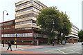
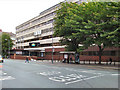
Photos of M1 2TT


Area Information
M1 2TT is a small residential postcode in England, home to 2,026 people. It is a compact area characterised by a high concentration of flats, reflecting its urban setting. The community is predominantly young, with a median age of 22 and the majority of residents falling within the 15–29 age range. This suggests a demographic skewed towards students, recent graduates, or young professionals. The area’s proximity to Manchester’s core infrastructure, including multiple rail and metro stations, ensures easy access to the city’s cultural, commercial, and educational hubs. Nearby amenities include retail outlets like Tesco and Sainsburys, alongside transport nodes such as Chorlton Street Coach Station and Piccadilly Gardens metro stop. While the area lacks natural landscapes, its connectivity to Manchester’s transport network and proximity to sixth-form colleges make it a practical choice for those prioritising convenience over green spaces. The low flood risk and absence of environmental constraints like AONB or protected woodlands further support its appeal, though residents should be mindful of the high crime risk reported in the area.
- Area Type
- Postcode
- Area Size
- Not available
- Population
- 2026
- Population Density
- 14828 people/km²
The property market in M1 2TT is dominated by rental flats, with only 16% of residents owning their homes. This suggests a market primarily driven by tenants rather than buyers, likely influenced by the area’s compact size and proximity to Manchester’s central amenities. The prevalence of flats indicates a focus on high-density living, which suits the young, transient population. For buyers, this area may present limited opportunities for owner-occupied properties, with most options being flats rather than detached or semi-detached homes. The small postcode size means the housing stock is concentrated, and the immediate surroundings likely offer similar dynamics. Potential buyers should consider whether the rental-focused nature of the market aligns with their long-term goals, as property appreciation may be slower compared to areas with higher home ownership rates.
House Prices in M1 2TT
No properties found in this postcode.
Energy Efficiency in M1 2TT
Residents of M1 2TT enjoy a range of amenities within walking distance or a short journey. Retail options include major chains like Tesco, Sainsburys, and Spar, ensuring access to groceries and daily essentials. The area’s proximity to metro and rail stations, such as St Peter’s Square and Deansgate, facilitates easy travel to Manchester’s cultural and commercial centres. While there are no parks or leisure facilities listed, the transport links mean residents can quickly access green spaces or entertainment in nearby areas. The presence of multiple transport hubs also enhances convenience, allowing swift movement between work, shopping, and social activities. The area’s compact size and connectivity make it ideal for those prioritising accessibility over expansive local amenities, though it may lack the self-contained charm of more suburban neighbourhoods.
Amenities
Schools
Residents of M1 2TT have access to two sixth-form colleges: City College Manchester and Shena Simon College. Both institutions cater to students aged 16 and above, offering A-level and vocational courses. This means the area is well-served for post-16 education but lacks primary or secondary schools, which may be a concern for families with younger children. The absence of schools for younger age groups suggests that families with children under 16 would need to seek education options elsewhere, potentially in nearby postcodes. The focus on sixth-form education aligns with the area’s youthful demographic, making it suitable for students pursuing further education or training. However, the lack of comprehensive schooling for all age groups is a practical consideration for prospective residents.
| Rank | School | Type | Entry gender | Ages |
|---|
Explore more schools in this area
Go to Schools tabDemographics
The population of M1 2TT is 2,026, with a median age of 22, indicating a youthful community. The most common age group is 15–29 years, suggesting a demographic skewed towards students and young professionals. Home ownership in the area is low, at just 16%, meaning the majority of residents are likely to be renting. The predominant accommodation type is flats, aligning with the area’s urban character. The largest ethnic group is the Asian community, though specific proportions are not quantified. This demographic profile implies a dynamic, transient population, possibly linked to nearby educational institutions or employment opportunities in Manchester. The low home ownership rate and high proportion of young adults may reflect a rental market catering to temporary stays or students. The absence of detailed deprivation data means the quality of life is inferred from infrastructure and amenities, which appear to support daily needs despite the high crime risk.
Household Size
Accommodation Type
Tenure
Ethnic Group
Religion
Household Composition
Age
Household Deprivation
NS-SEC
Explore more demographic insights in this area
Go to Demographics tabPlanning
Planning Constraints
- Flood RiskPremium
- Ramsar Wetland SitesPremium
- Area of Outstanding Natural BeautyPremium
- Protected Nature ReservePremium
- Protected WoodlandPremium