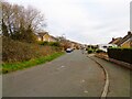
Area Overview for Longton & Hutton West Ward
Photos of Longton & Hutton West Ward
Area Information
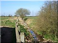
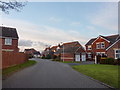
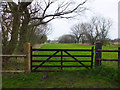
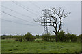
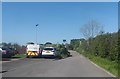
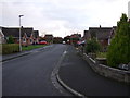
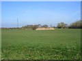
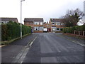
Longton & Hutton West Ward occupies a significant portion of rural England, spanning 19.6 square kilometres. Despite this size, the population is sparse, with only 1,404 residents recorded in this unitary ward. You will find a quiet environment where low population density shapes daily life. The definition of community here relies on proximity to specific local features rather than dense urban infrastructure. Most people living in this area enjoy open space and established residential settings. The ward functions as a distinct district where a mosaic of housing types supports a small but stable group of households. Your view from a property here will likely include natural surroundings rather than high-rise developments. The scale of the ward suggests a neighbourhood focused on established patterns of living rather than rapid change. Residents appreciate the relative isolation it provides while still maintaining access to wider county networks. You should expect a pace of life determined by the natural landscape surrounding Longton & Hutton West Ward. The historical character of the land often dictates the modern rhythm of the district.
- Area Type
- District Borough Unitary Ward
- Area Size
- 19.6 km²
- Population
- 1404
- Population Density
- 72 people/km²
Demographics
The community in Longton & Hutton West Ward is remarkably settled, with 88 per cent of households owning their homes outright or with a mortgage. This high level of ownership indicates a long-term resident base rather than a transient rental population. The average age of the population sits at 70 years, placing the most common age range firmly among senior citizens. You will encounter an elderly demographic where many families have resided in the ward for decades. Household composition reflects this older profile, with fewer young families moving into the area compared to other districts. The accommodation stock primarily serves those seeking stability and established living conditions rather than rapid turnover. While specific data on predominant ethnic groups or religious affiliation is not detailed in the available statistics, the high ownership rate suggests a well-established community structure. The demographic picture points to a tranquil environment suited to retirement or downsizing. Those looking for homes in Longton & Hutton West Ward will find a market defined by permanence. The lack of younger residents means services are likely tailored to an older population. You should verify local medical and social care needs based on this age skew. The neighbourhood's character remains consistent due to this steady demographic profile.
Household Size
Accommodation Type
Tenure
Ethnic Group
Religion
Household Composition
Age
Household Deprivation
NS-SEC
Explore more demographic insights in this area
Go to Demographics tabPlanning
Planning Constraints
- Flood RiskPremium
- Ramsar Wetland SitesPremium
- Area of Outstanding Natural BeautyPremium
- Protected Nature ReservePremium
- Protected WoodlandPremium
- Crime RiskPremium