Area Overview for Longsight Ward
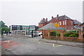
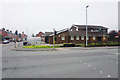
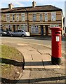
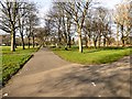
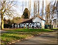
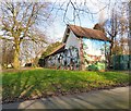
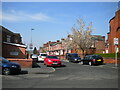
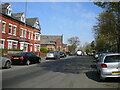
Photos of Longsight Ward
Area Information
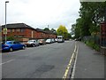
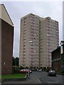
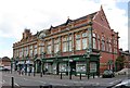
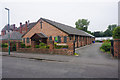
Longsight Ward is an inner-city district located within the City of Manchester in Greater Manchester. It sits approximately three miles south of the city centre along the historic A6 Stockport Road. The ward covers an area of 2.9 km² and holds a population of 7,697 residents. This compact footprint results in a population density of 2,679 people per square kilometre, which defines the area as a tightly packed urban environment. Its geography is bounded by Ardwick and West Gorton to the north and east, Levenshulme to the south, and Chorlton-on-Medlock, Victoria Park, and Fallowfield to the west. The location offers direct proximity to Manchester city centre while integrating with neighbouring communities. Longsight retains a complex history as a former chapelry that was incorporated into Manchester in 1890. It features significant historical sites such as Longsight Hall, which dates back to at least 1734, and Victorian villas surrounding Westpoint and Crowcroft Park. Daily life is characterised by accessibility to local amenities like Longsight Library and the nearby prestigious Victoria Baths. Living here means navigating a distinct urban landscape that blends Victorian architecture with modern council facilities. The area functions as a residential hub within the wider metropolitan grid, offering specific local transport links and historical depth. Prospective residents will find Longsight to be a defined part of Manchester with clear boundaries and established infrastructure.
- Area Type
- District Borough Unitary Ward
- Area Size
- 2.9 km²
- Population
- 7697
- Population Density
- 2679 people/km²
Demographics
The community profile for Longsight Ward reflects a settled population with a median age of 70 years. This high median age suggests that the ward attracts older residents as a primary lifestyle choice. Age distribution data indicates that the total population is the most common age range category recorded for the area. Household composition statistics are aggregated for the total ward population, indicating a mix of single-person homes and larger multi-generational households often found in inner-city districts. Accommodation type data covers the total stock available within the ward limits. A significant portion of the community identifies as British or White, representing the predominant ethnic group in the area. Religious affiliation data is aggregated for the total population, reflecting a diverse spiritual landscape typical of Manchester. Home ownership stands at 33%, meaning roughly two-thirds of the population rents their accommodation. This high rental rate implies a dynamic housing market with frequent turnover. The specific demographic figures paint a picture of an area dominated by older renters rather than a young, owner-occupier cohort. Understanding these demographic layers is essential for anyone considering homes in Longsight Ward. The data confirms a stable but ageing community where ownership rates remain relatively low compared to outer suburban wards.
Household Size
Accommodation Type
Tenure
Ethnic Group
Religion
Household Composition
Age
Household Deprivation
NS-SEC
Explore more demographic insights in this area
Go to Demographics tabPlanning
Planning Constraints
- Flood RiskPremium
- Ramsar Wetland SitesPremium
- Area of Outstanding Natural BeautyPremium
- Protected Nature ReservePremium
- Protected WoodlandPremium
- Crime RiskPremium