Area Overview for Littlemoor Ward
Photos of Littlemoor Ward


Area Information
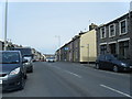
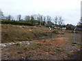
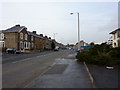
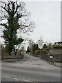
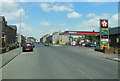
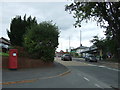
Living in Littlemoor Ward feels distinctly tied to the historic town of Clitheroe. This electoral ward sits within the Ribble Valley Borough Council area in North West England, encompassing just 1.4 square kilometres. Despite its small footprint, the ward functions as a key component of the local community, located directly near the town centre. The narrow boundaries suggest a tight-knit environment where daily life revolves around proximity to local services located in Clitheroe itself. You can walk to the main attractions without needing a personal vehicle for routine trips. The location at 53.8635°N, -2.3858°W places you in a well-established part of Lancashire that combines traditional charm with modern accessibility. Residents benefit from being part of a district that maintains a clear link to the wider borough while offering a specific, contained living environment. The ward profile from 2015 highlights its status as a defined electoral unit, giving you a clear understanding of the local governance structure that affects decisions regarding your immediate home.
- Area Type
- District Borough Unitary Ward
- Area Size
- 1.4 km²
- Population
- Not available
- Population Density
- Not available
Demographics
You will join a community with a clearly defined demographic make-up centred on older residents. The median age reaches seventy years, meaning half of the population is older than this figure. This age profile suggests a neighbourhood where retirement and established families dominate the social fabric. The data does not specify a single most common age bracket beyond the total population label, but the high median age points toward a quieter, more settled lifestyle compared to younger urban areas. Ownership of properties is strong here, with sixty-seven percent of residents living in their own homes. This indicates a stable market where long-term tenure is the norm rather than short-term renting. Household composition and accommodation type data cover the total population but do not break down specific family structures in the provided records. Ethnicity and religious beliefs are recorded for the total ward but lack detailed statistical breakdowns. You should expect an older, predominantly owner-occupied demographic that values stability and established community ties over rapid demographic shifts.
Household Size
Accommodation Type
Tenure
Ethnic Group
Religion
Household Composition
Age
Household Deprivation
NS-SEC
Explore more demographic insights in this area
Go to Demographics tabPlanning
Planning Constraints
- Flood RiskPremium
- Ramsar Wetland SitesPremium
- Area of Outstanding Natural BeautyPremium
- Protected Nature ReservePremium
- Protected WoodlandPremium
- Crime RiskPremium