Area Overview for Little Strickland
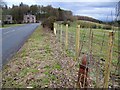
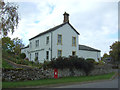
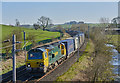
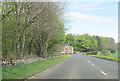
Photos of Little Strickland


Area Information
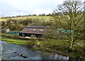
Living in Little Strickland means calling a small civil parish home within England. This settlement covers just 9.6 km², creating a compact environment where neighbours likely know one another. The area functions as a quiet rural community rather than a bustling town centre. Residents enjoy a peaceful setting characterised by natural spaces and established leadership structures. Daily life revolves around proximity to these defined boundaries and the surrounding countryside. You enter a locality defined by its modest size and rural nature. The parish format suggests a traditional governance model typical of English villages. There are no major commercial hubs within the 9.6 km² boundary, meaning shops and services are found elsewhere. This layout suits those seeking a slower pace of life away from urban congestion. The area offers a straightforward existence without the complexity of larger settlements. Prospective buyers should understand that this is a specialised community for specific lifestyles. The parish structure provides a sense of continuity and local identity. You will find that the land use is consistent with rural planning standards. The physical constraints of the small area mean development is limited. This consistency appeals to homeowners who value stability over rapid change. Little Strickland stands as a testament to the preservation of rural character in the modern era.
- Area Type
- Parish
- Area Size
- 9.6 km²
- Population
- Not available
- Population Density
- Not available
Demographics
The community profile of Little Strickland reflects a predominantly older population. The median age stands at exactly 70 years old, indicating a significant proportion of long-term residents. Most families have moved here decades ago and have remained in the village throughout their lives. Household composition data shows a disconnect with the simple label "total", suggesting diverse but age-specific arrangements. Home ownership reaches an impressive 80% of all households in the parish. This high figure means a very stable residential environment where people stay put rather than renting briefly. You can expect to deal mostly with tradespeople, solicitors, and other permanent residents when buying a home. The remaining 20% likely consists of younger people or those unable to secure mortgages in this specific location. Accommodation type data also reports "total", mirroring the household composition entry. This implies a standard mix of housing suitable for independent living rather than multi-generational apartments. Ethnically diverse influences are not highlighted in the available records, pointing to a relatively homogenous community structure. The demographic picture paints a clear image of retirement-oriented settlements or families who have chosen this quiet life permanently.
Household Size
Accommodation Type
Tenure
Ethnic Group
Religion
Household Composition
Age
Household Deprivation
NS-SEC
Explore more demographic insights in this area
Go to Demographics tabPlanning
Planning Constraints
- Flood RiskLocked
- Ramsar Wetland SitesLocked
- Area of Outstanding Natural BeautyLocked
- Protected Nature ReserveLocked
- Protected WoodlandLocked
- Crime RiskLocked