Area Overview for Little Lever & Darcy Lever Ward
Photos of Little Lever & Darcy Lever Ward
Area Information
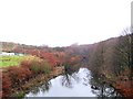
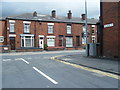
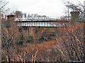
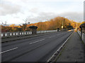
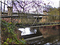
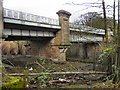
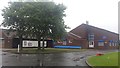
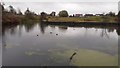
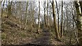
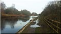
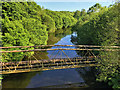
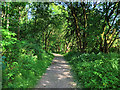
Living in Little Lever & Darcy Lever Ward offers a distinct experience shaped by its compact size and deep historical roots. This district, situated within the Metropolitan Borough of Bolton, covers an area of just 5.0 km² while housing a population of 1,539 residents. You are looking at a relatively small neutron village that forms part of a larger ward which held a population of 12,799 according to the 2011 Census. Despite the ward's larger historical footprint, the immediate area presents a quiet, residential character. The land here was originally bounded by the Rivers Irwell, Croal and Blackbrook, and the zone contains sites linked to the historic Manchester, Bolton and Bury Canal arms. You will find remnants of this industrial past, including former locations for the Ladyshore Terracotta Works and chemical plants established in 1868. Daily life in Little Lever & Darcy Lever Ward is defined by this blend of agriculture and industry, with the village located just two miles southeast of Bolton and two miles west of Radcliffe. The area does not contain designated protected status such as an Area of Outstanding Natural Beauty or Ramsar wetland sites. Instead, it stands as a practical residential zone where you gain proximity to major towns without the urban density of their centres.
- Area Type
- District Borough Unitary Ward
- Area Size
- 5.0 km²
- Population
- 1539
- Population Density
- 308 people/km²
Demographics
The community profile within Little Lever & Darcy Lever Ward reveals a settlement dominated by older residents. The median age for the population reaches 70 years, indicating that the typical resident falls well into retirement years. While the data categorises the most common age range broadly as "Total", this high median figure suggests the area is not a hub for young families or undergraduate populations. As you consider homes in Little Lever & Darcy Lever Ward, note that 74% of the local population owns their properties outright. This high ownership rate points to a neighbourhood where long-term stability is the norm, rather than a transient rental market dependent on temporary occupiers. The local accommodation types and household compositions support this static demographic structure. Diversity metrics regarding ethnicity and religion are recorded in total figures, reflecting the broader composition of the ward. Deprivation data is similarly presented in aggregate form, meaning you do not encounter pockets of acute poverty but rather a consistent community economic baseline. For those seeking a quiet retirement setting, this demographic balance works in your favour. The low population density of 308 people per square kilometre ensures that noise levels remain low.
Household Size
Accommodation Type
Tenure
Ethnic Group
Religion
Household Composition
Age
Household Deprivation
NS-SEC
Explore more demographic insights in this area
Go to Demographics tabPlanning
Planning Constraints
- Flood RiskPremium
- Ramsar Wetland SitesPremium
- Area of Outstanding Natural BeautyPremium
- Protected Nature ReservePremium
- Protected WoodlandPremium
- Crime RiskPremium