Area Overview for Little Harwood & Whitebirk Ward
Photos of Little Harwood & Whitebirk Ward
Area Information
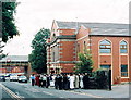
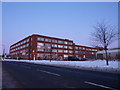
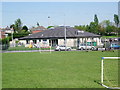
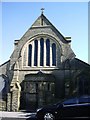
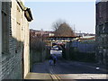
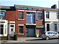
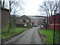
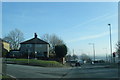
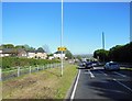
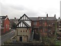
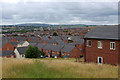
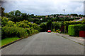
Living in Little Harwood & Whitebirk Ward offers a settled residential experience just two miles northeast of Blackburn town centre. This district borough unitary ward covers an area of 3.1 km² and serves as a suburban extension of the larger cotton town. The location sits at coordinates 53.752918, -2.45038, positioning it between the historic industrial heartland and the surrounding countryside. Whitebirk carries Saxon roots, meaning white or silver birch trees, and the ward encompasses sites with deep historical significance, including the Little Harwood Clock Tower which was unveiled in 1923. This structure functions as a war memorial and remains a focal point within maintained gardens. The area is defined by a mix of housing types, industrial units, and open land, reflecting its evolution from a township described in the 1870s to a modern residential zone. Early infrastructure included a tramway depot built alongside Whitebirk Road and later taken over by Blackburn Corporation, alongside the Leeds Liverpool Canal which currently crosses the landscape. You will find multiple mosques and churches scattered throughout the neighbourhood, indicating a multi-cultural character. The ward remains closely linked to the main line railway from Accrington to Blackburn, which runs along its northern border. Daily life here relies on established road networks connecting to Preston, Rishton, and Burnley. The combination of historical landmarks and functional transport links makes this a distinct choice for those seeking proximity to Blackburn without the immediate town centre density.
- Area Type
- District Borough Unitary Ward
- Area Size
- 3.1 km²
- Population
- Not available
- Population Density
- Not available
Demographics
The community profile in Little Harwood & Whitebirk Ward shows a settlement with a notably older demographic structure. The median age stands at 70 years, creating an environment dominated by long-term residents and retirees rather than young families or students. While the data lists the most common age range as 'Age: Total', the high median figure confirms that the population centre is well into later adulthood. Fifty-six per cent of households in this area own their homes outright, indicating a stable, owner-occupied population with deep local roots. This level of home ownership suggests that many residents have lived here for decades and have invested heavily in their local properties. You will encounter a mixture of housing stock rather than new-build developments, which aligns with the historical development of the ward from its origins as pasture land. The ward does not currently have specific data points detailing the predominant ethnic group or the primary religious affiliation; however, the physical presence of multiple mosques and churches confirms a diverse spiritual landscape. The area does not specify a breakdown of household composition beyond the aggregate total, implying a residential pattern typical of mature suburban zones. There is no indication of a transient population, as the stability is reinforced by the high rate of permanent home ownership. Living here means engaging with a community where the demographic balance heavily favours older age groups and established homeowners over rental tenants or younger demography.
Household Size
Accommodation Type
Tenure
Ethnic Group
Religion
Household Composition
Age
Household Deprivation
NS-SEC
Explore more demographic insights in this area
Go to Demographics tabPlanning
Planning Constraints
- Flood RiskPremium
- Ramsar Wetland SitesPremium
- Area of Outstanding Natural BeautyPremium
- Protected Nature ReservePremium
- Protected WoodlandPremium
- Crime RiskPremium