Area Overview for Leighton
Photos of Leighton

Area Information
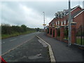
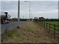
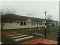
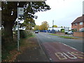
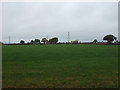
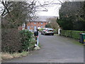
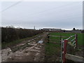
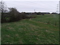
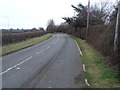
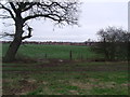
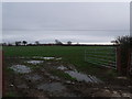
Leighton is a scattered settlement and civil parish situated in Cheshire East, located approximately one mile north west of Crewe. This quiet rural community covers an area of 4.9 km² and sits close to the borders of Worcestershire, Shropshire, and Staffordshire. The village itself includes the hamlet of Barrows Green, which lies on the northern outskirts of Crewe, along with nearby settlements such as Bradfield Green and Worleston. Historical records indicate the area was once a township in Nantwich Parish before becoming a civil parish in 1866. A Roman road runs through the parish, hinting at its ancient origins, while a Primitive Methodist chapel built in 1841 once served the local population. Today, residents enjoy proximity to significant infrastructure, with the A530 motorway running through the parish and major railway lines bordering the area to the south and west. Leighton Hospital provides accident and emergency services for South Cheshire on the A530. The landscape features Red Hall Wood and a small section within the Weaver Valley Area of Special County Value. Living in Leighton offers a distinct blend of rural charm and convenient access to larger town centres, making it a practical choice for those seeking a countryside feel without isolation.
- Area Type
- District Borough Unitary Ward
- Area Size
- 4.9 km²
- Population
- Not available
- Population Density
- Not available
Demographics
The community profile of Leighton reveals a population skewed distinctly towards older residents. The median age stands at 70 years, indicating that the majority of residents fall into the senior demographic. This age profile suggests a neighbourhood where long-term families and retirees are the primary demographic groups shaping daily life. Home ownership is exceptionally high, with 86% of properties owned outright or with a mortgage, reflecting a stable, settled community rather than a transient rental market. The census data from 2011 recorded a total population of 4,883 across the parish. While specific breakdowns for household composition, predominant ethnic groups, and religious affiliations are not detailed in the current dataset, the overwhelming home ownership rate suggests a traditional model of community building. The lack of young families or recent movers, given the high median age, means the local schools near Leighton likely cater to a different catchment area outside the parish boundaries. Residents here generally live in a predictable environment where community members know one another well, driven by decades of stable occupancy. This demographic reality shapes the area's character, prioritising leisure, retirement amenities, and local services suitable for an older population.
Household Size
Accommodation Type
Tenure
Ethnic Group
Religion
Household Composition
Age
Household Deprivation
NS-SEC
Explore more demographic insights in this area
Go to Demographics tabPlanning
Planning Constraints
- Flood RiskLocked
- Ramsar Wetland SitesLocked
- Area of Outstanding Natural BeautyLocked
- Protected Nature ReserveLocked
- Protected WoodlandLocked
- Crime RiskLocked