Area Overview for Leigh West Ward
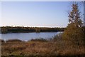
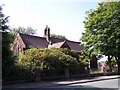
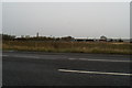
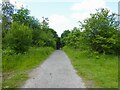
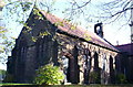
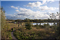
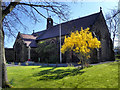
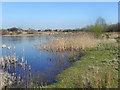
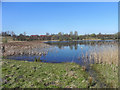
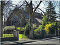
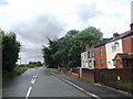
Photos of Leigh West Ward

Area Information
Leigh West Ward occupies a defined electoral district within Greater Manchester, covering an area of 7.9 km². This relatively compact space accommodates a population of 3,129 residents, creating a population density of 394 people per square kilometre. The ward serves as part of the Wigan Metropolitan Borough Council and falls under the parliamentary constituency of Leigh. Its geographic location sits at 53°30′11″N 2°32′47″W, placing it firmly within the industrial heritage landscape of the north-west. Residents here interact within a neighbourhood represented by three Labour councillors: Sue Greensmith, Dane Anderton, and Samantha Brown. Daily life in Leigh West Ward is characterised by a clear administrative structure and a sense of local governance. You are looking at a community where land use and residential density are balanced across almost eight square kilometres. The environment reflects its status as a borough unitary ward, with boundaries established for local political representation. Living in Leigh West Ward means engaging with a specific civic framework rather than a loose collection of villages. The area functions as a cohesive unit within the wider Leigh urban sprawl.
- Area Type
- District Borough Unitary Ward
- Area Size
- 7.9 km²
- Population
- 3129
- Population Density
- 394 people/km²
Demographics
The community profile of Leigh West Ward is distinctly older compared to the national average. The median age for residents is 70 years old, indicating that the area attracts a mature demographic. Data confirms that the most common age range is categorised as "Age: Total", suggesting a broad spread across adult life stages rather than focused on children or young families. Home ownership plays a significant role in the local economy, with 54% of households owning their properties outright. This majority of owner-occupied homes suggests stability within the local population structure. Household composition and accommodation types are recorded as total figures, meaning the ward comprises a mix of family units, retirees, and single occupants. The specific breakdown of predominant ethnic groups and religious affiliations is not detailed in the current records, but the statistics confirm the area hosts standard UK demographic patterns. You will find that the community is not primarily defined by young professionals or families with small children. Instead, the social fabric is woven around a senior population that has settled into long-term residences. This profile impacts local services, which are likely tailored towards health and leisure facilities needed by older adults. When considering homes in Leigh West Ward, you are looking at an area where the residents have a strong attachment to their current address.
Household Size
Accommodation Type
Tenure
Ethnic Group
Religion
Household Composition
Age
Household Deprivation
NS-SEC
Explore more demographic insights in this area
Go to Demographics tabPlanning
Planning Constraints
- Flood RiskPremium
- Ramsar Wetland SitesPremium
- Area of Outstanding Natural BeautyPremium
- Protected Nature ReservePremium
- Protected WoodlandPremium