Area Overview for Lees
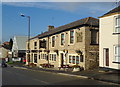
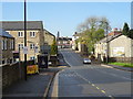
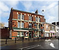
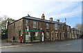
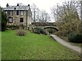
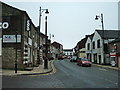
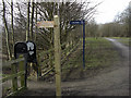
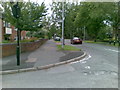
Photos of Lees
Area Information
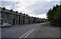
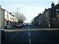
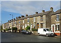
Lees is a built-up area located in Greater Manchester with a distinct residential character. The settlement covers 2.7 square kilometres, housing a population of 1,411 people. This density results in approximately 527 residents per square kilometre, creating a compact living environment typical of smaller towns. Daily life in Lees is shaped by this intimate scale, where the community feels closely knit despite being situated near larger urban centres. Prospective homebuyers considering living in Lees will find a neighbourhood defined by its established nature rather than rapid expansion. The area functions as a settled community where services and housing are contained within a relatively small footprint. You can expect a quiet routine punctuated by access to regional transport links and local retail options. The population figures indicate a stable community without the volatility found in areas experiencing migration surges. Living in Lees offers a specific type of suburban existence, balanced between independence and proximity to broader infrastructure. The area's identity is rooted in its history as a traditional residential zone, providing a predictable environment for those seeking a classic town setting.
- Area Type
- Built Up Area 250
- Area Size
- 2.7 km²
- Population
- 1411
- Population Density
- 527 people/km²
Residents of Lees enjoy practical access to a range of retail and travel amenities within easy reach. Supermarkets such as Co-op The, Aldi Athens Way, and Asda Oldham are among the notable retailers nearby. These shops satisfy essential shopping needs without requiring a long drive. Travel links are equally strong, with five metro stations including Oldham Mumps, Derker, and Oldham Central, alongside five rail stations like Mossley and Greenfield Railway Station. This proximity means you can commute to Manchester or the wider region efficiently. The combination of daily necessities and major transport hubs defines the lifestyle in Lees. You do not need to travel far for groceries or train tickets, reducing daily stress. The availability of five metro destinations and five railway stations ensures that Lees remains well-connected despite its built-up nature.
Amenities
Schools
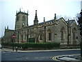
Parents living in Lees have access to several primary education options in the immediate vicinity. The area benefits from a concentration of schools serving infants and young children. These include Springhead Infant and Nursery School, Knowsley Junior School, Hey-with-Zion Primary School, St Agnes CofE Primary School, and St Thomas' Leesfield CofE Primary School. Of the institutions with recorded ratings, four hold a "good" Ofsted rating, covering Springhead, Knowsley, St Agnes, and St Thomas' Leesfield. There are no secondary schools listed within the immediate data scope for Lees, placing the upper-secondary education requirement on the children of residents further afield. The presence of multiple primary schools with good ratings offers families flexibility in choosing the right educational fit. For those considering schools near Lees, the local options provide a solid foundation for early education. The mix of Church of England and non-denominational primaries suggests a diverse educational offering suited to different family preferences.
| Rank | School | Type | Entry gender | Ages |
|---|
Explore more schools in this area
Go to Schools tabDemographics
The demographic profile of Lees reveals a community dominated by older residents. The median age is 70, which classifies this as a silver-mile community. This age distribution significantly influences the social fabric and local service needs within Lees. Home ownership stands at 65%, indicating that two-thirds of the households in this area own their properties outright. This high ownership rate typically correlates with long-term residents who have built strong ties to the locality. Accommodation types and household compositions reflect the aging population, though exact breakdowns for specific groups are not detailed in available records. The high level of home ownership suggests a settled population rather than a transient rental market. For those living in Lees, the community atmosphere is likely mature and established, with established social circles and minimal turnover. This aligns with the median age, where retirees and older families form the core of the demographic landscape.