Area Overview for Leasowe and Moreton East Ward
Photos of Leasowe and Moreton East Ward
Area Information
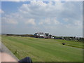
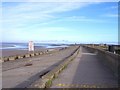
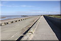
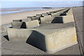
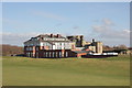
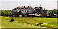
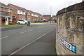
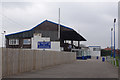
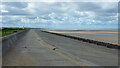
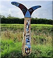
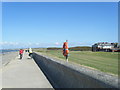
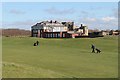
Leasowe and Moreton East Ward occupies a distinctive coastal position within the Metropolitan Borough of Wirral in Merseyside. This district stretches approximately 2-3 miles west of Wallasey along the north coast of the Wirral Peninsula. The ward covers an area of 9.4 square kilometres and serves a population of 3,285 residents. Living in Leasowe and Moreton East Ward means navigating a landscape defined by its Anglo-Saxon origins, where "Leasowe" translates to meadow pastures and "Moreton" means lake town. Much of the terrain is low-lying, with significant portions at or below sea level, protected by substantial coastal embankments. The area was historically prone to flooding and poor sanitation, but major drainage infrastructure installed by the Borough Council around 1926 transformed the location into a suitable residential zone. Today, the ward encompasses the Leasowe housing estate and East Moreton, offering a community deeply connected to local landmarks. Residents walk past Leasowe Castle, a Grade II* listed building originally constructed in 1593, alongside the historic Leasowe Lighthouse, the oldest brick-built light station in Britain which has operated since 1763. The largest sand dune system on the Wirral also defines the northern boundary of the estate.
- Area Type
- District Borough Unitary Ward
- Area Size
- 9.4 km²
- Population
- 3285
- Population Density
- 351 people/km²
Demographics
The community in Leasowe and Moreton East Ward has a distinct age profile with a median age of 70 years. This data suggests the population skews significantly towards older residents compared to the national average. House ownership stands at a precise 60% of the total households within the ward. This high proportion of owner-occupiers indicates a stable, long-term residential population rather than a transient rental market. The ward functions as a retirement-focused locale, which influences local services and community activities. While specific breakdowns for household composition, predominant ethnic groups, and religious affiliations are not detailed in the current figures, the age statistic provides a clear picture of the demographic makeup. You can expect to live amongst an established community where many families have resided for decades or where retirees have moved for retirement. This concentration of older households often correlates with a quieter neighbourhood environment and a reliance on accessible local amenities and transport links. The socio-demographic reality of the ward is shaped largely by this senior population, which drives demand for specific types of housing and local services designed for an older demographic.
Household Size
Accommodation Type
Tenure
Ethnic Group
Religion
Household Composition
Age
Household Deprivation
NS-SEC
Explore more demographic insights in this area
Go to Demographics tabPlanning
Planning Constraints
- Flood RiskPremium
- Ramsar Wetland SitesPremium
- Area of Outstanding Natural BeautyPremium
- Protected Nature ReservePremium
- Protected WoodlandPremium
- Crime RiskPremium