Area Overview for Lea
Photos of Lea
Area Information
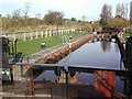
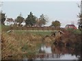
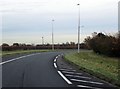
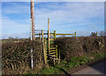
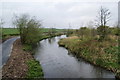
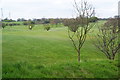
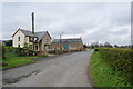
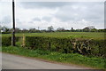
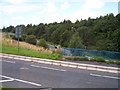
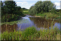
Lea is a civil parish situated within the City of Preston district in Lancashire, North West England. This small community spans just 8.4 square kilometres and functions as a suburb approximately four miles west of Preston city centre. Residents live in the villages of Lea, Cottam, and Lea Town, which together form a cohesive part of the Preston urban area. The location lies north of the River Ribble at an elevation of 22 metres and coordinates around 53.77°N, 2.79°W. Living in Lea offers a straightforward mix of rural charm and city access. The parish includes twelve listed buildings recognised by the National Heritage List for England, adding character to the built environment. Local landmarks include the Lea Gate pub, which sits at the site of a former toll crossing over Savick Brook. A restored roadside cross monument stands nearby near Lea Road and Cottam Way, dedicated in 1929. Historical depth marks the landscape, with records dating back to the Domesday Book of 1086 when the settlement appeared as "laeh". The area encompasses three distinct villages that merge around the A583 road, which runs directly through the parish. This route historically connected Preston to Blackpool and included a private toll road owned by the de Hoghton estates until 1902. cottam Hall, a notable local site, links to the historical de Hoghton family through former marriages. While William Haydock of Cottam Hall faced execution in 1537 during the Pilgrimage of Grace, the modern community remains peaceful and established. Homes in Lea benefit from proximity to St Mary's Church and St Mary's Catholic Primary School. The combination of historical significance and practical location makes this parish a grounded choice for those seeking stability near Preston without the immediate pressure of city living.
- Area Type
- Parish
- Area Size
- 8.4 km²
- Population
- Not available
- Population Density
- Not available
Demographics
The demographic landscape of Lea tells a clear story of an older, settled population. The median age stands at 70, indicating that the majority of residents are senior citizens. This concentration creates a community where the total age group represents the most common demographic category. With a population fluctuating between 5,962 and 7,150 across its constituent villages, the area maintains a tight-knit character dominated by families and elderly residents. Home ownership drives the social fabric, with 83% of households owned outright or with a mortgage. This high level of tenure suggests stability and long-term residents rather than a transient population. The household composition reflects this settled nature, though specific breakdowns for family structures vary. Accommodation types follow the general total trend for the parish, aligning with the older demographic profile. Ethnic diversity and religious affiliation follow the total population distribution typical for a civil parish in Lancashire. Deprivation levels do not feature prominently in the available statistics, but the high home ownership rate implies financial stability among the base. There are no data points suggesting significant economic distress or relative poverty in the provided records. The population structure means that daily life revolves around retirement activities and established routines rather than youthful commuting patterns. Schools near Lea such as St Mary's Catholic Primary School serve the younger families who remain in this older environment. The community feels static yet secure, where neighbours have known each other for decades. Living in Lea involves joining a cohort where the average person is significantly older than the national UK average. This creates a quiet environment where property values reflect stability and low turnover. Buyers should expect a community that values tradition and consistency over rapid change.
Household Size
Accommodation Type
Tenure
Ethnic Group
Religion
Household Composition
Age
Household Deprivation
NS-SEC
Explore more demographic insights in this area
Go to Demographics tabPlanning
Planning Constraints
- Flood RiskPremium
- Ramsar Wetland SitesPremium
- Area of Outstanding Natural BeautyPremium
- Protected Nature ReservePremium
- Protected WoodlandPremium
- Crime RiskPremium