Area Overview for Latchford East Ward
Photos of Latchford East Ward

Area Information
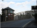
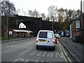
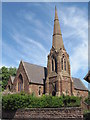
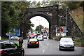
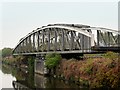
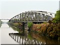
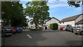
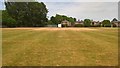
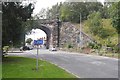
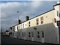
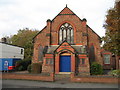
Living in Latchford East Ward offers a settled residential experience within the Warrington Borough Council area. This district covers 2.2 km² and serves 1,698 residents. You will find yourself approximately one mile south-east of Warrington town centre, situated between the River Mersey and the Manchester Ship Canal. The location places you close to notable infrastructure such as the Knutsford Road Swing Bridge and the Latchford High Level Bridge. Your daily life centres on a predominantly residential suburb developed largely in the 19th century. Sir Thomas Boteler Church of England High School stands as a key landmark in the broader Latchford area. This ward provides a defined community environment where residents navigate a landscape shaped by historic development and major waterways. The specific boundaries ensure a compact living space where the town centre remains accessible yet distinct. Families and long-term residents find the geography manageable, with local amenities and transport links positioned to support everyday needs without excessive travel distances.
- Area Type
- District Borough Unitary Ward
- Area Size
- 2.2 km²
- Population
- 1698
- Population Density
- 762 people/km²
Demographics
People moving to Latchford East Ward should expect a mature community. The median age here is 70, indicating an older population likely retired or living later in life. You will interact primarily with residents in older age ranges rather than young families or students. Consistent with this age profile, 49% of homes are owner-occupied, suggesting many residents have lived here for decades. While the ward comprises various accommodation types, the high ownership rate points toward stability within established households. The area does not target specific ethnic groups or religious affiliations; data shows the total population reflects the standard diversity of the region without a single predominant group dominating. There is no indication of deprivation levels in the current records, but the age structure suggests a community focused on quiet living rather than active nightlife or student housing. Those seeking a demographic aligned with typical retirement communities will find the character of Latchford East Ward matches that expectation closely.
Household Size
Accommodation Type
Tenure
Ethnic Group
Religion
Household Composition
Age
Household Deprivation
NS-SEC
Explore more demographic insights in this area
Go to Demographics tabPlanning
Planning Constraints
- Flood RiskPremium
- Ramsar Wetland SitesPremium
- Area of Outstanding Natural BeautyPremium
- Protected Nature ReservePremium
- Protected WoodlandPremium
- Crime RiskPremium