Area Overview for LA9 7FF
Photos of LA9 7FF
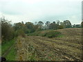
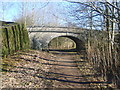
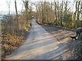
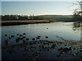
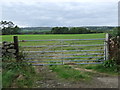
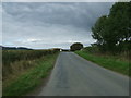
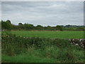
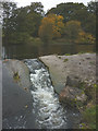
29 photos from this area
Area Information
Key information about the LA9 7FF including its size, population, and administrative classification.
- Area Type
- Postcode
- Area Size
- 6.3 hectares
- Population
- 2155
- Population Density
- 73 people/km²
House Prices in LA9 7FF
46
Properties
£255,219
Average Sold Price
£79,000
Lowest Price
£525,000
Highest Price
Showing 46 properties
| Address | Type | Beds | Baths | Last Sale Price | Last Sale Date | |
|---|---|---|---|---|---|---|
| 6 Beechnut Road, Kendal, LA9 7FF | Detached | 4 | 2 | £480,000 | Aug 2025 | |
| 10 Beechnut Road, Kendal, LA9 7FF | Detached | 4 | 2 | £510,000 | Mar 2025 | |
| 30 Beechnut Road, Kendal, LA9 7FF | Detached | 4 | 1 | £525,000 | Jun 2024 | |
| 19 Beechnut Road, Kendal, LA9 7FF | house | - | - | £500,000 | Feb 2022 | |
| 18 Beechnut Road, Kendal, LA9 7FF | house | - | - | £315,000 | Dec 2021 | |
| 26 Beechnut Road, Kendal, LA9 7FF | Semi-detached | 3 | 2 | £300,000 | Jun 2021 | |
| 25 Beechnut Road, Kendal, LA9 7FF | Detached | 4 | 2 | £382,500 | Nov 2019 | |
| 51 Beechnut Road, Kendal, LA9 7FF | house | - | - | £297,950 | Jun 2016 | |
| 8 Beechnut Road, Kendal, LA9 7FF | house | - | - | £399,950 | Mar 2016 | |
| 61 Beechnut Road, Kendal, LA9 7FF | house | - | - | £112,100 | Feb 2016 |
Page 1 of 5
Energy Efficiency in LA9 7FF
Amenities
Schools
| Rank | School | Type | Entry gender | Ages |
|---|
Explore more schools in this area
Go to Schools tabDemographics
Household Size
Two person
most common
Accommodation Type
Houses
most common
Tenure
86
majority
Ethnic Group
White
most common
Religion
N/A
most common
Household Composition
N/A
most common
Age
47
median
Adults (30-64 years)
most common
Household Deprivation
N/A
with no deprivation
NS-SEC
48
in Lower managerial occupations
Explore more demographic insights in this area
Go to Demographics tabPlanning
Planning Constraints
- Flood RiskPremium
- Ramsar Wetland SitesPremium
- Area of Outstanding Natural BeautyPremium
- Protected Nature ReservePremium
- Protected WoodlandPremium