Area Overview for LA9 7DZ
Photos of LA9 7DZ

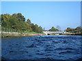

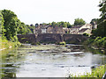


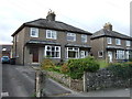
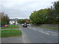
67 photos from this area
Area Information
Key information about the LA9 7DZ including its size, population, and administrative classification.
- Area Type
- Postcode
- Area Size
- 2.9 hectares
- Population
- 1219
- Population Density
- 4122 people/km²
House Prices in LA9 7DZ
26
Properties
£198,200
Average Sold Price
£62,000
Lowest Price
£340,000
Highest Price
Showing 26 properties
| Address | Type | Beds | Baths | Last Sale Price | Last Sale Date | |
|---|---|---|---|---|---|---|
| 54 Lound Road, Kendal, LA9 7DZ | house | - | - | £257,500 | Jan 2025 | |
| 60 Lound Road, Kendal, LA9 7DZ | Terraced | 3 | 1 | £280,000 | Nov 2024 | |
| 32 Lound Road, Kendal, LA9 7DZ | Terraced | 3 | 1 | £205,000 | Aug 2023 | |
| 56 Lound Road, Kendal, LA9 7DZ | Terraced | 2 | 1 | £255,000 | May 2023 | |
| 38 Lound Road, Kendal, LA9 7DZ | Terraced | 4 | 2 | £235,000 | Sep 2021 | |
| 52 Lound Road, Kendal, LA9 7DZ | house | - | - | £260,000 | Aug 2021 | |
| 22 Lound Road, Kendal, LA9 7DZ | Semi-detached | 3 | 2 | £233,000 | Jun 2021 | |
| 50 Lound Road, Kendal, LA9 7DZ | Terraced | 4 | 2 | £340,000 | Sep 2020 | |
| 26 Lound Road, Kendal, LA9 7DZ | Terraced | 3 | - | £143,500 | Jun 2013 | |
| 24 Lound Road, Kendal, LA9 7DZ | house | - | - | £165,000 | Nov 2009 |
Page 1 of 3
Energy Efficiency in LA9 7DZ
Amenities
Schools
| Rank | School | Type | Entry gender | Ages |
|---|
Explore more schools in this area
Go to Schools tabDemographics
Household Size
One person
most common
Accommodation Type
Houses
most common
Tenure
53
majority
Ethnic Group
White
most common
Religion
N/A
most common
Household Composition
N/A
most common
Age
47
median
Adults (30-64 years)
most common
Household Deprivation
N/A
with no deprivation
NS-SEC
30
in Lower managerial occupations
Explore more demographic insights in this area
Go to Demographics tabPlanning
Planning Constraints
- Flood RiskPremium
- Ramsar Wetland SitesPremium
- Area of Outstanding Natural BeautyPremium
- Protected Nature ReservePremium
- Protected WoodlandPremium