Area Overview for LA9 5EX
Photos of LA9 5EX
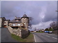
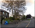
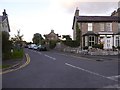
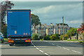
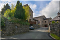
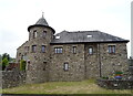
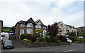
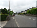
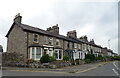
28 photos from this area
Area Information
Key information about the LA9 5EX including its size, population, and administrative classification.
- Area Type
- Postcode
- Area Size
- 1.7 hectares
- Population
- 2292
- Population Density
- 4343 people/km²
House Prices in LA9 5EX
30
Properties
£149,576
Average Sold Price
£39,000
Lowest Price
£345,000
Highest Price
Showing 30 properties
| Address | Type | Beds | Baths | Last Sale Price | Last Sale Date | |
|---|---|---|---|---|---|---|
| 28 Underley Hill, Kendal, LA9 5EX | Semi-detached | 4 | 2 | £345,000 | Jan 2025 | |
| 1 Underley Hill, Kendal, LA9 5EX | Semi-detached | 3 | 1 | £295,000 | Sep 2020 | |
| 23 Underley Hill, Kendal, LA9 5EX | Semi-detached | 2 | 1 | £203,500 | Dec 2017 | |
| 16 Underley Hill, Kendal, LA9 5EX | house | - | - | £176,000 | Jun 2016 | |
| 21 Underley Hill, Kendal, LA9 5EX | Semi-detached | 3 | - | £222,000 | Apr 2015 | |
| 10 Underley Hill, Kendal, LA9 5EX | Semi-detached | 3 | - | £215,000 | Feb 2014 | |
| 22 Underley Hill, Kendal, LA9 5EX | house | - | - | £215,375 | Sep 2013 | |
| 7 Underley Hill, Kendal, LA9 5EX | house | 3 | - | £206,000 | Oct 2012 | |
| 30 Underley Hill, Kendal, LA9 5EX | house | - | - | £175,000 | Jun 2010 | |
| 17 Underley Hill, Kendal, LA9 5EX | house | - | - | £189,000 | Jan 2010 |
Page 1 of 3
Energy Efficiency in LA9 5EX
Amenities
Schools
| Rank | School | Type | Entry gender | Ages |
|---|
Explore more schools in this area
Go to Schools tabDemographics
Household Size
Family (3-5 people)
most common
Accommodation Type
Houses
most common
Tenure
60
majority
Ethnic Group
White
most common
Religion
N/A
most common
Household Composition
N/A
most common
Age
47
median
Adults (30-64 years)
most common
Household Deprivation
N/A
with no deprivation
NS-SEC
28
in Lower managerial occupations
Explore more demographic insights in this area
Go to Demographics tabPlanning
Planning Constraints
- Flood RiskPremium
- Ramsar Wetland SitesPremium
- Area of Outstanding Natural BeautyPremium
- Protected Nature ReservePremium
- Protected WoodlandPremium