Area Overview for LA8 9PR
Photos of LA8 9PR
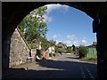
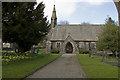
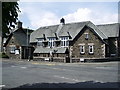
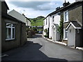
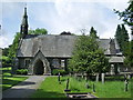
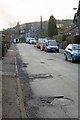
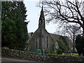
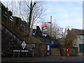
85 photos from this area
Area Information
Key information about the LA8 9PR including its size, population, and administrative classification.
- Area Type
- Postcode
- Area Size
- 17.5 hectares
- Population
- 2199
- Population Density
- 28 people/km²
House Prices in LA8 9PR
14
Properties
£384,000
Average Sold Price
£200,000
Lowest Price
£545,000
Highest Price
Showing 14 properties
| Address | Type | Beds | Baths | Last Sale Price | Last Sale Date | |
|---|---|---|---|---|---|---|
| Hill Crest, Danes Road, Staveley, LA8 9PR | house | - | - | £465,000 | Mar 2025 | |
| Bobbin Cottage, Danes Road, Staveley, LA8 9PR | Detached | 4 | - | £545,000 | Dec 2022 | |
| 1, Meadowlands, Danes Road, Staveley, LA8 9PR | Semi-detached | 3 | 1 | £475,500 | Jun 2021 | |
| 1, Fellside, Danes Road, Staveley, LA8 9PR | Semi-detached | 3 | 1 | £340,000 | Jun 2021 | |
| 2, Meadowlands, Danes Road, Staveley, LA8 9PR | Semi-detached | 4 | - | £385,000 | Jul 2013 | |
| Brantholme, Danes Road, Staveley, LA8 9PR | Flat | 1 | 1 | £200,000 | May 2009 | |
| Fallows, Danes Road, Staveley, LA8 9PR | Semi-detached | 3 | 1 | £277,500 | Jan 2003 | |
| Reston Mill, Danes Road, Staveley, LA8 9PR | Semi-detached | 6 | 3 | - | - | |
| Dane Crest, Danes Road, Staveley, LA8 9PR | Detached | - | - | - | - | |
| Scar Foot, Danes Road, Staveley, LA8 9PR | Detached | - | - | - | - |
Page 1 of 2
Energy Efficiency in LA8 9PR
Amenities
Schools
| Rank | School | Type | Entry gender | Ages |
|---|
Explore more schools in this area
Go to Schools tabDemographics
Household Size
Two person
most common
Accommodation Type
Houses
most common
Tenure
72
majority
Ethnic Group
White
most common
Religion
N/A
most common
Household Composition
N/A
most common
Age
47
median
Adults (30-64 years)
most common
Household Deprivation
N/A
with no deprivation
NS-SEC
37
in Lower managerial occupations
Explore more demographic insights in this area
Go to Demographics tabPlanning
Planning Constraints
- Flood RiskPremium
- Ramsar Wetland SitesPremium
- Area of Outstanding Natural BeautyPremium
- Protected Nature ReservePremium
- Protected WoodlandPremium