Area Overview for LA8 9JF
Photos of LA8 9JF
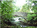
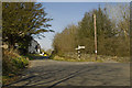
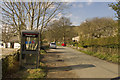
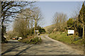
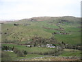
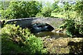
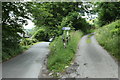
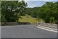
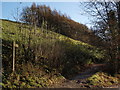
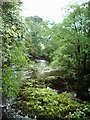
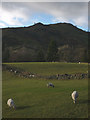
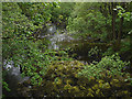
21 photos from this area
Area Information
Key information about the LA8 9JF including its size, population, and administrative classification.
- Area Type
- Postcode
- Area Size
- 46.9 hectares
- Population
- 2199
- Population Density
- 28 people/km²
House Prices in LA8 9JF
18
Properties
£462,096
Average Sold Price
£50,000
Lowest Price
£1,056,480
Highest Price
Showing 18 properties
| Address | Type | Beds | Baths | Last Sale Price | Last Sale Date | |
|---|---|---|---|---|---|---|
| 5, Fellfoot Cottages, Kentmere Road, Staveley, LA8 9JF | house | - | - | £363,000 | Nov 2023 | |
| Shellkorbar, Kentmere Road, Staveley, LA8 9JF | house | - | - | £50,000 | Aug 2014 | |
| Elf Howe, Kentmere Road, Staveley, LA8 9JF | Bungalow | - | - | £1,056,480 | Nov 2008 | |
| Heywood, Kentmere Road, Staveley, LA8 9JF | Detached | - | - | £456,000 | Jul 2008 | |
| Sunnywood, Kentmere Road, Staveley, LA8 9JF | Terraced | - | - | £385,000 | Sep 2007 | |
| Low Elf Howe, Kentmere Road, Staveley, LA8 9JF | house | 5 | 3 | - | - | |
| Caravan, Hill View, Kentmere Road, Staveley, LA8 9JF | Mobile Home | - | - | - | - | |
| Hill View, Kentmere Road, Staveley, LA8 9JF | house | - | - | - | - | |
| Caravan, Sunny Orchard, Kentmere Road, Staveley, LA8 9JF | Mobile Home | - | - | - | - | |
| Kent View, Kentmere Road, Staveley, LA8 9JF | house | - | - | - | - |
Page 1 of 2
Energy Efficiency in LA8 9JF
Amenities
Schools
| Rank | School | Type | Entry gender | Ages |
|---|
Explore more schools in this area
Go to Schools tabDemographics
Household Size
Two person
most common
Accommodation Type
Houses
most common
Tenure
72
majority
Ethnic Group
White
most common
Religion
N/A
most common
Household Composition
N/A
most common
Age
47
median
Adults (30-64 years)
most common
Household Deprivation
N/A
with no deprivation
NS-SEC
37
in Lower managerial occupations
Explore more demographic insights in this area
Go to Demographics tabPlanning
Planning Constraints
- Flood RiskPremium
- Ramsar Wetland SitesPremium
- Area of Outstanding Natural BeautyPremium
- Protected Nature ReservePremium
- Protected WoodlandPremium