Area Overview for LA6 2QX
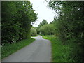
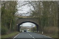
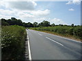
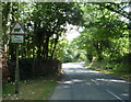
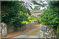
Photos of LA6 2QX


Area Information
Living in LA6 2QX offers a quiet, low-density lifestyle in a small residential cluster. With a population of just 1183 people spread over 24 people per square kilometre, the area feels unspoiled and intimate. This is a place where families and older adults predominate, with a median age of 47 and a strong presence of those aged 30–64. The community is largely home-owned, with 77% of properties occupied by their owners, reflecting a stable, settled population. Daily life here is characterised by proximity to essential services, with two railway stations within reach and five retail outlets nearby. While the area lacks large-scale amenities, its charm lies in its simplicity—ideal for those seeking a peaceful, manageable environment. The low population density means fewer crowds and a slower pace, though the small size of the area means residents often know their neighbours. LA6 2QX is not for those craving urban vibrancy, but it offers a secure, low-maintenance alternative to busier regions.
- Area Type
- Postcode
- Area Size
- Not available
- Population
- 1183
- Population Density
- 48 people/km²
The property market in LA6 2QX is characterised by high home ownership (77%) and a focus on houses rather than flats or apartments. This suggests a market that caters to families and individuals seeking private, spacious homes rather than rental properties. The small size of the area means the housing stock is limited, but the prevalence of owner-occupied properties indicates a strong sense of local attachment. For buyers, this presents a niche opportunity: the area is unlikely to see rapid development or new builds, making it a stable but static market. The lack of rental properties also means competition for available homes is likely low, though the small size of the area may restrict choice. Buyers should consider the area’s appeal to those prioritising quiet, low-density living over proximity to urban centres.
House Prices in LA6 2QX
No properties found in this postcode.
Energy Efficiency in LA6 2QX
The lifestyle in LA6 2QX is defined by its proximity to essential amenities and a modest selection of retail options. Within practical reach are five retail outlets, including Spar, Booths Kirkby, and Co-op High, providing access to groceries, petrol, and basic services. The two nearby railway stations—Wennington and Bentham—enhance mobility, allowing residents to travel to larger towns for more specialised shopping or leisure. While the area lacks large parks or entertainment venues, the low population density and quiet environment may appeal to those prioritising peace over convenience. The retail options are sufficient for daily needs but limited in variety, requiring trips to nearby towns for broader choices. Overall, the lifestyle here is simple and functional, ideal for those valuing a low-maintenance, self-contained existence.
Amenities
Schools
Residents of LA6 2QX have access to a range of schools, including two Church of England primary schools: Hornby St Margaret’s (Ofsted rating: satisfactory) and Melling St Wilfrid (Ofsted rating: good). Hornby High School, also listed as a primary school, adds to the local options, though its rating is not specified. For families seeking independent education, Oneschool Global Uk Lancaster Campus provides a private alternative. The mix of state and independent schools offers flexibility, though the absence of secondary school details may be a consideration for parents planning long-term. The quality of local primary education varies, with Melling St Wilfrid performing better than average. For those prioritising school ratings, the good-rated Melling St Wilfrid is a clear strength, while the independent option caters to those seeking alternative curricula.
| Rank | School | Type | Entry gender | Ages |
|---|
Explore more schools in this area
Go to Schools tabDemographics
The community in LA6 2QX is predominantly composed of adults aged 30–64, with a median age of 47. This suggests a mature population, likely with established careers and families. Home ownership is high at 77%, indicating a stable housing market where most residents are long-term occupants. The accommodation type is primarily houses, which aligns with the area’s low population density and suggests a preference for private, spacious living. The predominant ethnic group is White, though no further breakdown is provided. The absence of specific data on deprivation or diversity means the area’s social fabric is not fully quantified, but the high home ownership and age profile imply a relatively affluent, settled community. For residents, this translates to a predictable, low-stress environment with minimal turnover. However, the limited demographic detail means broader social dynamics remain unexplored.
Household Size
Accommodation Type
Tenure
Ethnic Group
Religion
Household Composition
Age
Household Deprivation
NS-SEC
Explore more demographic insights in this area
Go to Demographics tabPlanning
Planning Constraints
- Flood RiskPremium
- Ramsar Wetland SitesPremium
- Area of Outstanding Natural BeautyPremium
- Protected Nature ReservePremium
- Protected WoodlandPremium