Area Overview for LA6 1DA
Photos of LA6 1DA
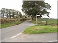
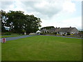
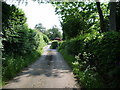

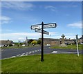
26 photos from this area
Area Information
Key information about the LA6 1DA including its size, population, and administrative classification.
- Area Type
- Postcode
- Area Size
- 1.9 hectares
- Population
- 2280
- Population Density
- 55 people/km²
House Prices in LA6 1DA
19
Properties
£230,500
Average Sold Price
£135,000
Lowest Price
£430,000
Highest Price
Showing 19 properties
| Address | Type | Beds | Baths | Last Sale Price | Last Sale Date | |
|---|---|---|---|---|---|---|
| The Barn, Kirkby Lonsdale Road, Over Kellet, LA6 1DA | Detached | 4 | 2 | £430,000 | Oct 2023 | |
| Old Hall, Kirkby Lonsdale Road, Over Kellet, LA6 1DA | house | - | - | £220,000 | Jun 2020 | |
| Holly Bush House, Kirkby Lonsdale Road, Over Kellet, LA6 1DA | house | - | - | £135,000 | Dec 2019 | |
| Plough Cottage, Kirkby Lonsdale Road, Over Kellet, LA6 1DA | Detached | - | - | £180,000 | Sep 2008 | |
| Plough House, The Green, Over Kellet, LA6 1DA | house | 3 | 2 | £187,499 | Jul 2005 | |
| 1, Old Hall Cottages, Kirkby Lonsdale Road, Over Kellet, LA6 1DA | Terraced | - | - | - | - | |
| 2, Old Hall Cottages, Kirkby Lonsdale Road, Over Kellet, LA6 1DA | Terraced | - | - | - | - | |
| Old Hall Cottage, Kirkby Lonsdale Road, Over Kellet, LA6 1DA | Detached | - | - | - | - | |
| Lime Tree Cottage, The Green, Over Kellet, LA6 1DA | house | 2 | 1 | - | - | |
| Hogarth Cottage, Kirkby Lonsdale Road, Over Kellet, LA6 1DA | Detached | - | - | - | - |
Page 1 of 2
Energy Efficiency in LA6 1DA
Amenities
Schools
| Rank | School | Type | Entry gender | Ages |
|---|
Explore more schools in this area
Go to Schools tabDemographics
Household Size
Two person
most common
Accommodation Type
Houses
most common
Tenure
85
majority
Ethnic Group
White
most common
Religion
N/A
most common
Household Composition
N/A
most common
Age
47
median
Adults (30-64 years)
most common
Household Deprivation
N/A
with no deprivation
NS-SEC
39
in Lower managerial occupations
Explore more demographic insights in this area
Go to Demographics tabPlanning
Planning Constraints
- Flood RiskPremium
- Ramsar Wetland SitesPremium
- Area of Outstanding Natural BeautyPremium
- Protected Nature ReservePremium
- Protected WoodlandPremium