Area Overview for LA5 9LQ
Photos of LA5 9LQ
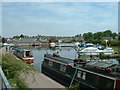
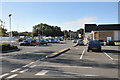
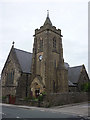
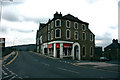
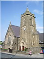
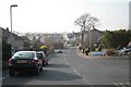
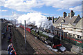
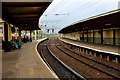
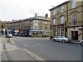
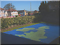
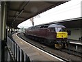
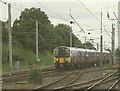
100 photos from this area
Area Information
Key information about the LA5 9LQ including its size, population, and administrative classification.
- Area Type
- Postcode
- Area Size
- 9189 m²
- Population
- 1343
- Population Density
- 396 people/km²
House Prices in LA5 9LQ
11
Properties
£136,861
Average Sold Price
£35,500
Lowest Price
£264,000
Highest Price
Showing 11 properties
| Address | Type | Beds | Baths | Last Sale Price | Last Sale Date | |
|---|---|---|---|---|---|---|
| 15 North Road, Carnforth, LA5 9LQ | Detached | 3 | 1 | £230,000 | Jan 2025 | |
| 17 North Road, Carnforth, LA5 9LQ | Bungalow | 3 | - | £264,000 | Jan 2022 | |
| 7 North Road, Carnforth, LA5 9LQ | Terraced | 5 | 2 | £95,250 | Feb 2021 | |
| 3 North Road, Carnforth, LA5 9LQ | Terraced | 4 | 1 | £181,000 | Sep 2019 | |
| 5 North Road, Carnforth, LA5 9LQ | Terraced | 6 | 1 | £90,000 | Apr 2019 | |
| 13 North Road, Carnforth, LA5 9LQ | Terraced | 5 | 1 | £136,000 | Mar 2012 | |
| 12 North Road, Carnforth, LA5 9LQ | Terraced | 2 | 1 | £110,000 | Dec 2011 | |
| 10 North Road, Carnforth, LA5 9LQ | office_workshop | - | - | £90,000 | Apr 2001 | |
| 9 North Road, Carnforth, LA5 9LQ | house | - | - | £35,500 | Mar 2000 | |
| Flat Above, 1 North Road, Carnforth, LA5 9LQ | Terraced | 2 | 1 | - | - |
Page 1 of 2
Energy Efficiency in LA5 9LQ
Amenities
Schools
| Rank | School | Type | Entry gender | Ages |
|---|
Explore more schools in this area
Go to Schools tabDemographics
Household Size
Two person
most common
Accommodation Type
Houses
most common
Tenure
77
majority
Ethnic Group
White
most common
Religion
N/A
most common
Household Composition
N/A
most common
Age
47
median
Adults (30-64 years)
most common
Household Deprivation
N/A
with no deprivation
NS-SEC
33
in Lower managerial occupations
Explore more demographic insights in this area
Go to Demographics tabPlanning
Planning Constraints
- Flood RiskPremium
- Ramsar Wetland SitesPremium
- Area of Outstanding Natural BeautyPremium
- Protected Nature ReservePremium
- Protected WoodlandPremium