Area Overview for LA5 9EN
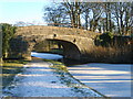
Photos of LA5 9EN
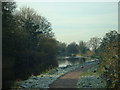
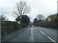
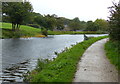
![Cyclist approaching Thwaite End Bridge [No 127] in LA5 9EN](https://images.propbar.co.uk/images/geograph/58/40/5840841_120.jpg)
42 photos from this area
Area Information
Key information about the LA5 9EN including its size, population, and administrative classification.
- Area Type
- Postcode
- Area Size
- 3970 m²
- Population
- 1621
- Population Density
- 1290 people/km²
House Prices in LA5 9EN
8
Properties
£204,325
Average Sold Price
£56,000
Lowest Price
£293,000
Highest Price
Showing 8 properties
| Address | Type | Beds | Baths | Last Sale Price | Last Sale Date | |
|---|---|---|---|---|---|---|
| 17 Long Acre Close, Carnforth, LA5 9EN | Bungalow | 2 | 1 | £210,000 | Jan 2024 | |
| 5 Long Acre Close, Carnforth, LA5 9EN | Bungalow | - | - | £293,000 | Feb 2021 | |
| 7 Long Acre Close, Carnforth, LA5 9EN | Bungalow | 3 | 1 | £292,000 | Dec 2020 | |
| 9 Long Acre Close, Carnforth, LA5 9EN | Bungalow | - | - | £199,950 | Sep 2017 | |
| 3 Long Acre Close, Carnforth, LA5 9EN | Bungalow | - | - | £175,000 | Oct 2012 | |
| 15 Long Acre Close, Carnforth, LA5 9EN | Semi-detached | - | - | £56,000 | Apr 1998 | |
| 11 Long Acre Close, Carnforth, LA5 9EN | Semi-detached | 3 | 2 | - | - | |
| 1 Long Acre Close, Carnforth, LA5 9EN | Semi-detached | - | - | - | - |
Energy Efficiency in LA5 9EN
Amenities
Schools
| Rank | School | Type | Entry gender | Ages |
|---|
Explore more schools in this area
Go to Schools tabDemographics
Household Size
Two person
most common
Accommodation Type
Houses
most common
Tenure
83
majority
Ethnic Group
White
most common
Religion
N/A
most common
Household Composition
N/A
most common
Age
47
median
Adults (30-64 years)
most common
Household Deprivation
N/A
with no deprivation
NS-SEC
30
in Lower managerial occupations
Explore more demographic insights in this area
Go to Demographics tabPlanning
Planning Constraints
- Flood RiskPremium
- Ramsar Wetland SitesPremium
- Area of Outstanding Natural BeautyPremium
- Protected Nature ReservePremium
- Protected WoodlandPremium