Area Overview for LA5 9AD
Photos of LA5 9AD
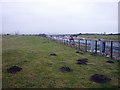
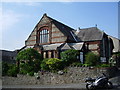
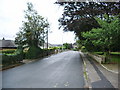
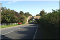
96 photos from this area
Area Information
Key information about the LA5 9AD including its size, population, and administrative classification.
- Area Type
- Postcode
- Area Size
- 1.4 hectares
- Population
- 1507
- Population Density
- 2216 people/km²
House Prices in LA5 9AD
34
Properties
£111,675
Average Sold Price
£22,270
Lowest Price
£180,000
Highest Price
Showing 34 properties
| Address | Type | Beds | Baths | Last Sale Price | Last Sale Date | |
|---|---|---|---|---|---|---|
| 25 Prince Avenue, Carnforth, LA5 9AD | Detached | 3 | 1 | £180,000 | Jun 2025 | |
| 26 Prince Avenue, Carnforth, LA5 9AD | house | - | - | £144,000 | Jan 2023 | |
| 27 Prince Avenue, Carnforth, LA5 9AD | Semi-detached | 3 | 2 | £130,000 | Jan 2021 | |
| 24 Prince Avenue, Carnforth, LA5 9AD | Semi-detached | 3 | - | £135,000 | Aug 2019 | |
| 12 Prince Avenue, Carnforth, LA5 9AD | Semi-detached | 3 | 1 | £120,000 | Dec 2016 | |
| 3 Prince Avenue, Carnforth, LA5 9AD | house | - | - | £109,000 | Oct 2016 | |
| 2 Prince Avenue, Carnforth, LA5 9AD | house | - | - | £135,000 | Jul 2013 | |
| 18 Prince Avenue, Carnforth, LA5 9AD | house | 3 | - | £102,000 | May 2011 | |
| 28 Prince Avenue, Carnforth, LA5 9AD | house | 3 | - | £140,000 | Aug 2007 | |
| 14 Prince Avenue, Carnforth, LA5 9AD | Semi-detached | - | - | £136,000 | Jul 2007 |
Page 1 of 4
Energy Efficiency in LA5 9AD
Amenities
Schools
| Rank | School | Type | Entry gender | Ages |
|---|
Explore more schools in this area
Go to Schools tabDemographics
Household Size
Family (3-5 people)
most common
Accommodation Type
Houses
most common
Tenure
61
majority
Ethnic Group
White
most common
Religion
N/A
most common
Household Composition
N/A
most common
Age
47
median
Adults (30-64 years)
most common
Household Deprivation
N/A
with no deprivation
NS-SEC
19
in Lower managerial occupations
Explore more demographic insights in this area
Go to Demographics tabPlanning
Planning Constraints
- Flood RiskPremium
- Ramsar Wetland SitesPremium
- Area of Outstanding Natural BeautyPremium
- Protected Nature ReservePremium
- Protected WoodlandPremium